Search Results
Tri-Valley teen’s message to parents: Get your kids on transit!

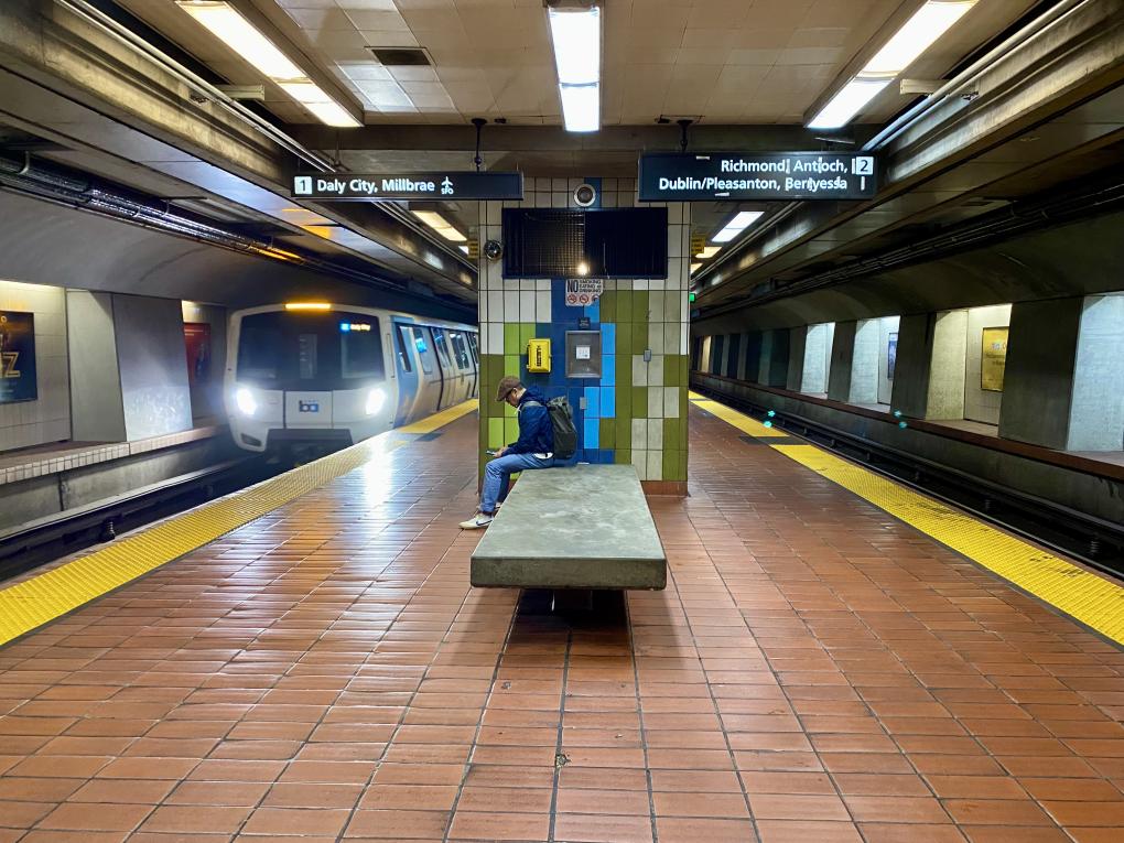
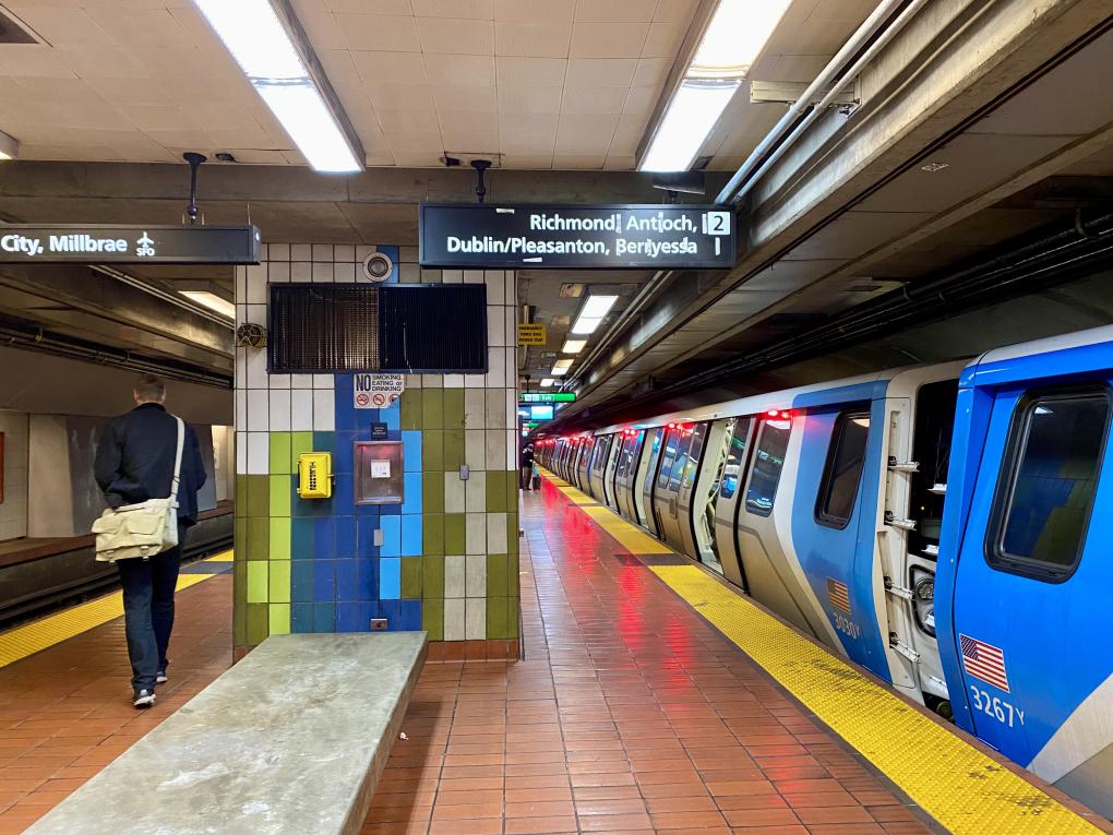
Enzo Wu, 15, is pictured on a BART train.
Listen to Enzo Wu, Ameen DaCosta, and YouTuber Adam discuss the art of speedrunning on the BART podcast.
Enzo Wu is a BART speedrun world recordholder. He’s also a San Ramon teenager working to “spread the gospel of transit.”
“A lot of people I know haven’t actually gone out and tried transit, and they form their opinions about it from family or social media,” Wu said recently. His longstanding question: How can you know you don’t want to ride transit if you’ve never actually ridden it?
Wu believes public transportation is an important tool for people his age. You don’t have to have a license, and you don’t have to beg your parents to drop you off and pick you up. You can just go when you want to, where you want to (with your parents’ permission, of course).
Wu has been working to get his friends to take transit by inviting them to take BART to an unexplored location and offering to pay their fare and even buy them dinner. That's how much the transit cause matters to him.
“People my age don’t go out and do stuff in public enough,” he said. “They’re not getting out there and interacting with new people offline, and if they’re bored on a weekend, they’ll sit around all day and play videogames."
There’s nothing wrong with videogames – Wu's a big gamer himself – but there’s more to life than screens, he said. Transit is his foolproof balm for boredom. It’s also provided him with plentiful opportunities to practice independence and social skills.
“Going out in public, riding the train, these are activities that build social confidence, which so many kids lack these days,” said Wu (who’s darn mature for his 15 years, if you hadn’t noticed). “Knowing how to take a train or a bus or a ferry is a big step in growing up.”
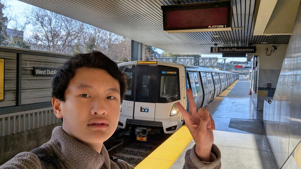
Some of his friends have never done anything alone, let alone take the train from the Tri-Valley to San Francisco, he added.
“We’ll go to a restaurant, and they’ll get stressed because they don’t know how to pay the bill,” he said. “It’s kind of shocking. They lack social skills. But I think transit can bridge that gap. Some of my friends won’t necessarily take transit everywhere like I do, but just getting the idea in their heads is a big step.”
The hurdle isn’t always social; sometimes, it’s parental.
“Some of my friends are game to go into San Francisco and check out a new spot I found,” Wu said. “But then their parents say no.”
“I just find that so sad,” he continued. “Many parents haven’t even tried transit themselves! They see a headline and form an instant opinion. Can you imagine if people did that with airplane travel? If you actually have a decent understanding of traveling by transit, you wouldn’t prevent your kid from riding it, especially during the day and with a group.”
Only two years ago, Wu himself had almost no experience on public transportation. It was his mom who inadvertently gave him the transit bug when she signed him up for 511 Contra Costa’s Pass2Class, a program that gives middle and high school students free bus rides to school for up to two months.
When Wu’s mom first gave him the card with the expectation that he’d at least try taking the bus home from school, he replied: “You want me to take the bus??? Ewwwwww.”
“Enzo, just try it,” she said. “If it’s bad, we’ll find you a carpool.” You know what happened next.
Now, Wu’s getting his parents on the transit train. He regularly shares “good transit news” along with his long list of positive BART and bus experiences. It’s boosted his parent’s confidence in his ability to be out in the world alone, he said. Now they don’t think twice about letting him head out on his own.
Wu has many “transit conversion” success stories to share. Once he gets a friend onboard – that first ride experience is key – it’s not uncommon for the transit ingenue to become transit oriented. He believes he’s “converted” at least a dozen friends directly and dozens more indirectly, thanks to people who watch his speedrun videos and livestreams.
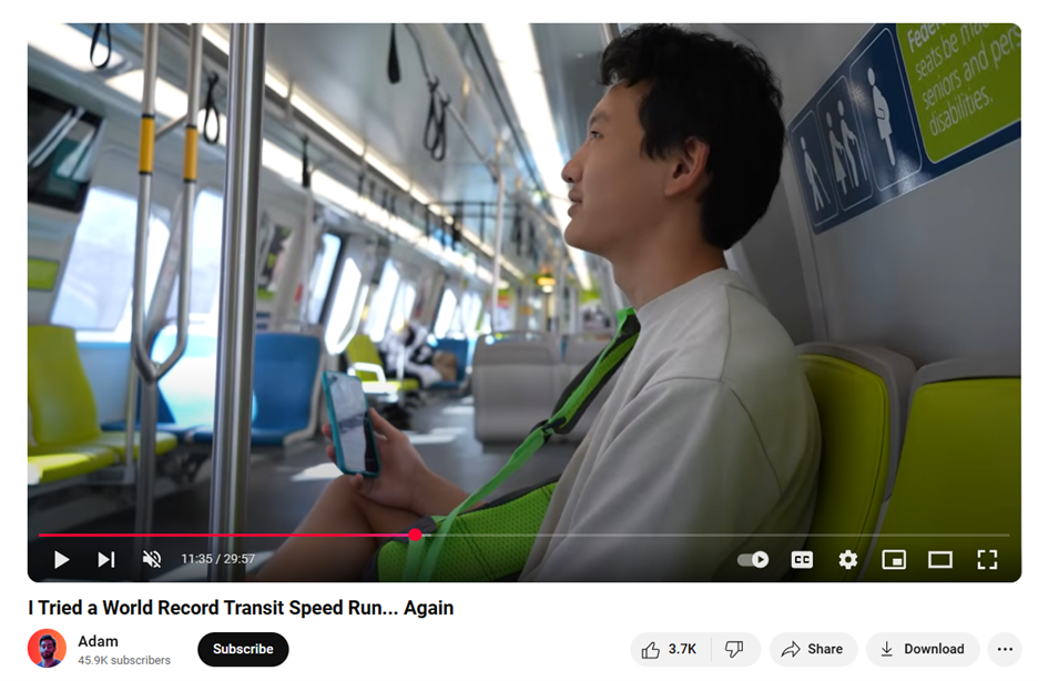
If you’re unacquainted with the term, a speedrun is the total time it takes to travel through all BART stations (or another form of transportation). You can learn more about BART speedrun records here and watch the invigorating video of Wu and YouTuber Adam's new BART speedrun world record here. This past October, the duo speedran the BART system with a time of 5 hours, 9 minutes, and 35 seconds.
“Even just people posting the articles about my speedruns in their Discord chats – people go, ‘Woah, that’s cool Enzo does that. Maybe I should check BART out,’” he said. Now, thanks to the success of his videos, it’s not uncommon for friends to ask to tag along on upcoming runs.
Speedrunning is something of an unconventional hobby (though a solid extracurricular for college apps, Wu hopes). Other than countering some of the transit-negative narratives on social media, the act of speedrunning demonstrates that “if you plan a route in advance, your transit experience can work out well.”
“Once you get experience, planning your trip is fun, simple, and stress free,” Wu said.
And Wu knows it will serve him and his friends as they transition into adulthood.
“Building transit skills now will come in handy many years down the line when you need to get to college, to work,” he said. “That’s why I ride transit, and that’s why I’m advocating for kids my age to do the same.”
“If you can’t ride transit without freaking out, you’ll lose out on all these experiences,” he concluded. “Then, you’ll look back and say, ‘Why didn’t I take transit earlier? Enzo gave me a great opportunity, and I said no!’”
BART offers a 50% fare discount for youth ages five to 18 years old with a Youth Clipper card. Children four years old and younger ride free. Learn more about Youth Clipper cards and other fare discounts here.
The definitive history of the BARTmobile on its 20th birthday
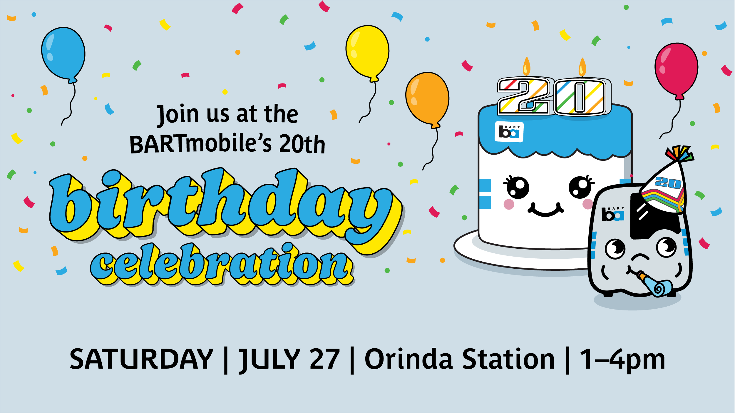
Join us Saturday, July 27, at Orinda Station to toast the BARTmobile on chugging its way to 20 years. More event info here.
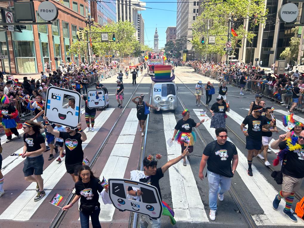
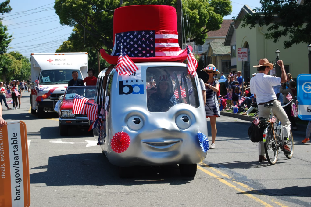
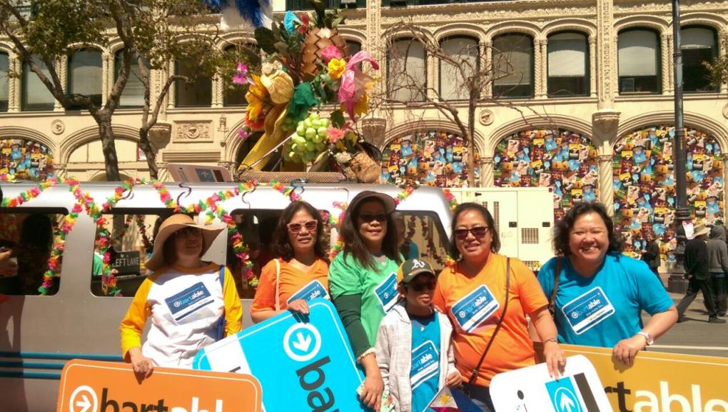
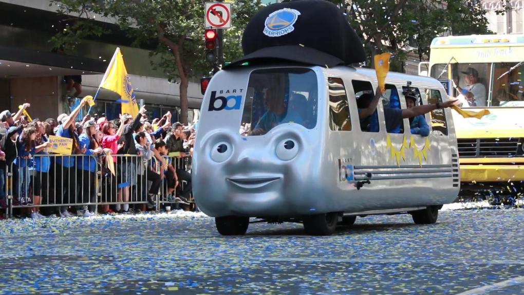
The BARTmobile in the 2024 San Francisco Pride Parade. Watch the parade from the BARTmobile's perspective on Instagram.
It has been said that its eyes can see through to your soul. Some have speculated it has the power to improve society. Those who cross its path are known to start acting joyfully and sometimes erratically. It’s even slowed traffic on the Bay Bridge.
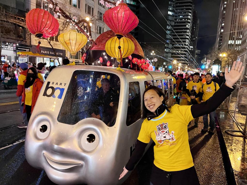
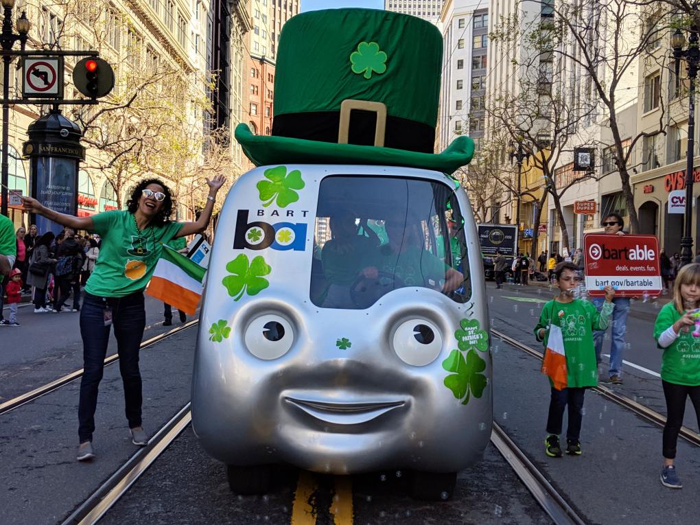
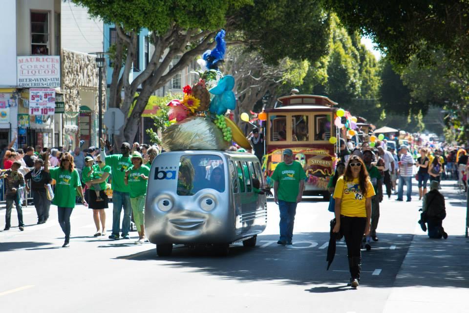
If you have found yourself at a major Bay Area parade in the last two decades, chances are high you’ve encountered this mystical being, known as the BARTmobile.
The BARTmobile inspires in passersby what some may deem insane behavior. As it rolls down its given route, paradegoers will scream and shout at the anthropomorphic train as if it were Taylor Swift – “The BARTmobile is here! The BARTmobile is here!” In many instances, adults and children alike will dig through their wallets and pull out their Clipper cards, waving them maniacally at the BARTmobile’s smiling face as it rolls by.
But what exactly is the BARTmobile? And how did it come to have such a hold on the hearts and minds of Bay Area residents?
Jill Buschini, Principal Marketing Representative at BART, has been the official “BARTmobile wrangler” for the past eight parade seasons. She ensures the mobile gets where it needs to go for its bevy of local engagements. (Note: The BARTmobile currently participates only in major Bay Area parades and festivals.)
“When the BARTmobile arrives anywhere, the attention it gets still astounds me. It's incredibly fun to see and be part of!” said Buschini. “Kids and adults alike are transfixed by the small BART train with a face.”
Buschini said even the Golden State Warriors, during their 2022 Warriors Championship Parade, pointed and cheered at the BARTmobile when it caught their eye along the parade route.
There are a handful of crafty, ingenious folks responsible for birthing the BARTmobile. But there is one man responsible for kicking things off. That would be Doug Bartlett, a now-retired BART Principal Marketing Representative.
“Basically, anything that wasn’t normal BART marketing business was thrown to me,” Bartlett said, speaking by phone recently.
In the early 2000s, Bartlett arranged for a series of BART appearances in local parades and happenings. At that time, the Buildings and Grounds department lent BART paradegoers a few logo-emblazoned trucks to walk beside.
“The vehicles were obviously gas-powered,” Bartlett said. “It didn’t seem right. BART is electric!”
The BARTmobile by the Numbers
Weight | Height | Width | Length | Max Load | Max Speed | Battery | Seats |
704 lbs | 6 feet | 5 feet | 14 feet | 1,500 lbs | 15 mph | 12 Volts | 8 |
As a temporary solution, Bartlett began renting three-wheelers. They didn’t really have anything to do with BART, but they were electric, at least.
Then, Bartlett attended an Oakland Athletics game at the Coliseum. At the game, the team had golfcart-sized Chevron cars on display, as well as miniature cars to give to children. A switch flipped in Bartlett’s mind: “I said, ‘We should do this with a BARTmobile.’”
From that day forward, Bartlett set out to make the most fantastical, most adorable, most kid friendly BARTmobile possible.
“The justification was, my god, the San Francisco Gay Pride Parade is seen by more than one million people, just for starters,” Bartlett said. “In one year, a BARTmobile could be seen by more than five million people. It could obviously be justified from a marketing perspective.”
The wheels truly began turning on Halloween 2001, when the Commuter Check Service Corporation, a pre-tax commuter benefit solutions provider, agreed to donate $75,000 to cover the cost needed to construct the entirely electric BARTmobile, as well as a trailer and storage container for it to call home.
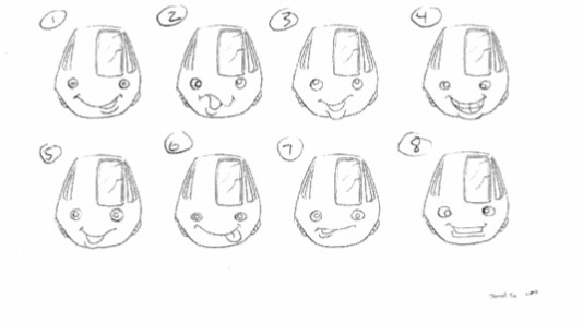
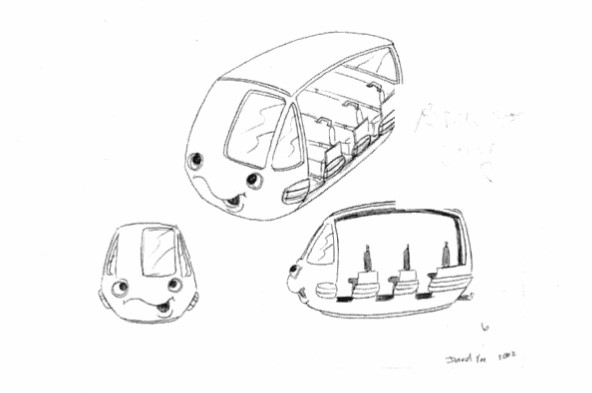
Initial concept sketches for the face of the BARTmobile by David Yee.
With funding secured, the design process began. First, playwright and carpenter Tony Pelligrino sculpted a model. Then, designer David Yee created initial sketches and concept art, trying to determine the right face for the roving mascot.
“Some of these drawings were the coolest I’d ever seen in my life -- think ‘Star Wars’ meets Tesla,” Bartlett remembered. “It was nuts! But at the same time, we had to dial it in to make it really look like a BARTmobile.”
Bartlett said the design team went “more for the character, the softness, the cuteness.”
“I wanted future BART riders to look at this as if BART has a personality,” Bartlett said. “We went through many iterations trying to get that face to look happy, but not strange. Some of the drawings were absolutely demonic – like Chucky leading the BARTmobile.”
Bartlett eventually connected with Charlie Bailey of Industrial Light and Magic, the Marin-based visual effects company founded by George Lucas in the 1970s.
“At the time [Bailey] was building the BARTmobile, his crew was building a massive ship for the ‘Pirates of the Caribbean’ movie. It was like 40 feet long!” Bartlett remembered.
Bailey and his colleague Mark Anderson, of the freelance Bailey Design Services team, built the BARTmobile on nights and weekends out of Anderson’s garage. First, they sculpted the face and the rear of the train out of foam and built the middle section from plywood and polyurethanes. They then painted the model and made a mold of the train, which was used to create the fiberglass body. Inspiration for the shape and style of the BARTmobile came from 1958 VW buses and Corvette concept cars.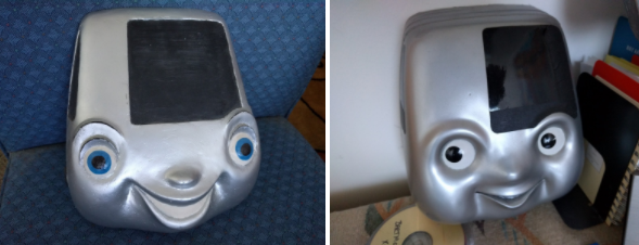
At some point, Anderson and Bailey – who could not be reached for comment – purchased an eight-seater golf cart from Bay Area Golf Carts, which they reinforced with steel. Finally, they built a steel chassis and secured the fiberglass body atop the cart. The last step: painting the BARTmobile with blue bumper strips and Chrysler silver.
Then came the electrical wiring. According to Bartlett, the same Industrial Light and Magic team that worked on “Star Wars” designed and installed the BARTmobile’s electronics. They even converted an actual BART train horn to run on 12-volt battery for the friendly faced vehicle.
“Generally speaking, we had all these incredible guys who oddly loved this project,” Bartlett said. “It was something so different. It was a challenge. And unlike a lot of their projects, it would be around for years to come.”
Bartlett is a musician – he said his current music project is making tunes for robots and aliens – so he was “obsessed” with equipping the BARTmobile with “giant speakers and a monster amp.” Today, he is proud to say that the BARTmobile’s sound system “will rattle your bones” at full throttle, thanks in part to a subwoofer that’s the size of an entire bench – a “must have” for Bartlett.
If you’ve ever witnessed the BARTmobile in a local parade, you will certainly have noticed its “outfits.” The mascot has a variety of specially constructed hats that it wears depending on the occasion: a top hat with rotating “skins” for St. Patrick’s Day, July Fourth, Pride, and the holiday season; a Lunar New Year hat; a Carmen Miranda hat (complete with giant fruit); and a baseball cap for sporting events.
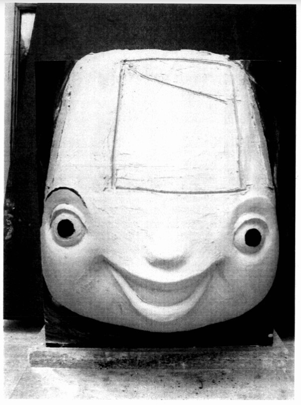
A foam sculpture of the BARTmobile face.
The hats, like all things BARTmobile, have a story of their own. They were made by a team of crafty, creative individuals at Scientific Art Studio, a design and fabrication studio in Richmond that creates everything from museum exhibits to playgrounds and sculptures.
“The BARTmobile was one of those things,” said Ron Holthuysen, the Creative Director and Owner of Scientific Art Studio. “We had a hard time saying no [to the project]. When somebody comes to us, we typically say, ‘Oh yeah, we can do that.’”
To create the hats, Holthuysen began by drawing some concepts. Then, it was a matter of finding the right materials that were “lightweight but also durable,” said Gordon Glasgow, Shop Manager at Scientific Art Studio.
Once they found the materials – they range from heavy cotton to a “very fancy” silk brocade – Glasgow began crafting patterns as well as foam inner structures that would ensure the hats kept their shape and wouldn’t break. What couldn’t be found in stores, the designers made themselves.
“We do basically everything [at Scientific Art Studio],” Holthuysen said. “That’s how we ended up doing BARTmobile hats.”
Construction of the BARTmobile completed in February of 2004. The mascot was unveiled shortly thereafter with a “birthday party,” intended to attract “visibility for marketing programs to gain riders,” according to the run-of-show document for the day. A fife and drum corps kicked off the celebration, which also featured a birthday cake, train-themed CDs (it was the early 2000s after all), and toy train giveaways.
Since then, the BARTmobile has appeared at a multitude of events, driven over 250 miles, and seen by millions of people. To use Bartlett’s phrasing, the mobile has indelibly “put a face on BART.”
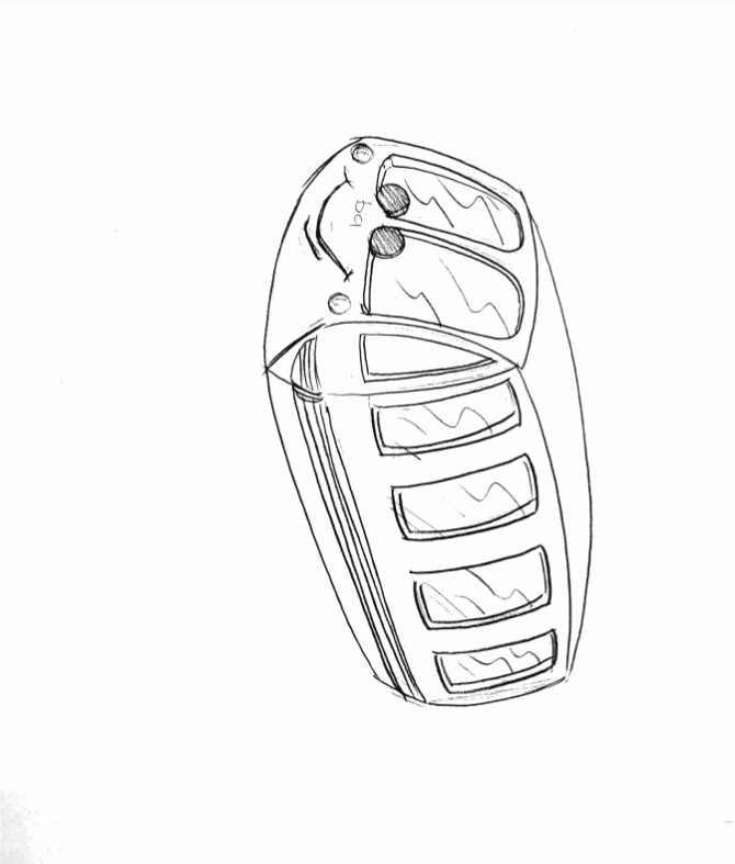
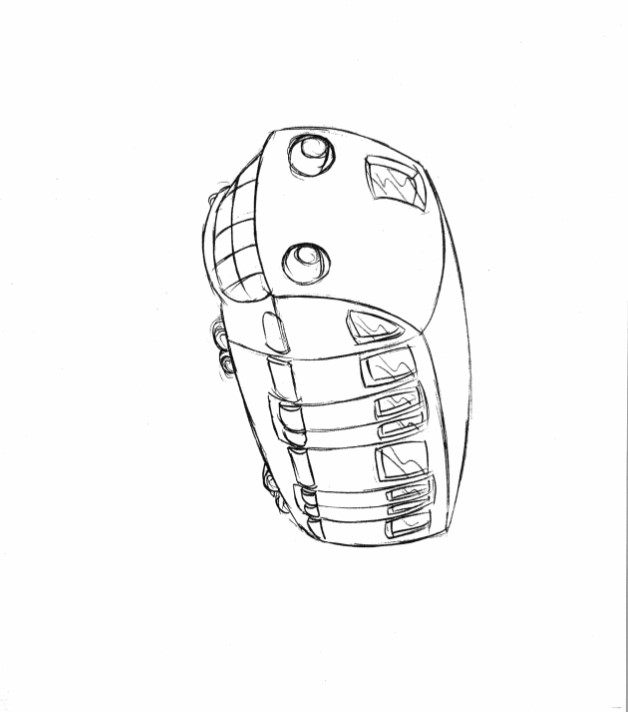
Initial concept sketches for the BARTmobile.
But the BARTmobile would never be seen in public were it not for its army of “handlers” – the BART workers who prepare and transport it to its multitude of engagements.
“I started working at BART in 2018. Since then, every time there’s a parade, I’m trying to get on [BARTmobile duty],” said Tomasz Radzikowski, Buildings Worker. Radzikowski estimates he’s delivered the mobile from its home, in BART’s Oakland Shop Annex, to local events at least six times.
“It’s a very exciting thing to do,” he said. “I like it – no, I love it.”
To prepare the BARTmobile for an event, one team of BART workers polish the chassis, charge the electronics, and soundcheck the stereo. This crew is also in charge of decorating, as well as dressing the BARTmobile in its event-specific hat.
From there, a second team loads and secures the BARTmobile on a special trailer. They’ll drive it from the Oakland Shop Annex to wherever it needs to appear that day and unload the 700-pound vehicle. At the end of the event, the process repeats itself in reverse.
“Whenever we drive from the Oakland shops to the city, people will wave at us and ask us to pull over to take pictures,” Radzikowski said. “Sometimes, people on the Bay Bridge will slow down because they’re so excited to see it.”
Radzikowski often hangs around the parade until it’s time to pack the BARTmobile back up. He said the joy and energy from the crowd when they see the mobile rolling down the street is palpable.
“You can see the good vibes and happiness,” he said. “It’s a beautiful feeling to experience.”
Show your support for extending pre-tax transit commuter benefits
As a Bay Area transit rider, you might have been taking advantage of the federal pre-tax commuter benefit. But you might not have heard that Congress let the tax provision expire at the end of 2011 and it is no longer applicable --unless Congress acts to re-establish this important tax benefit. Without an
Temporary parking changes at Daly City Station June 2017
Starting Saturday, 3 June, 2017, we will begin work reconstructing the upper-level parking lot next to John Daly Blvd/Delong Street at our Daly City Station (click here for map). The project will include a redesign and paving of the Delong Parking lot (upper BART surface lot) that will include a new bus
Minor schedule adjustments go into effect on Monday 8/12/24 to improve service and connections
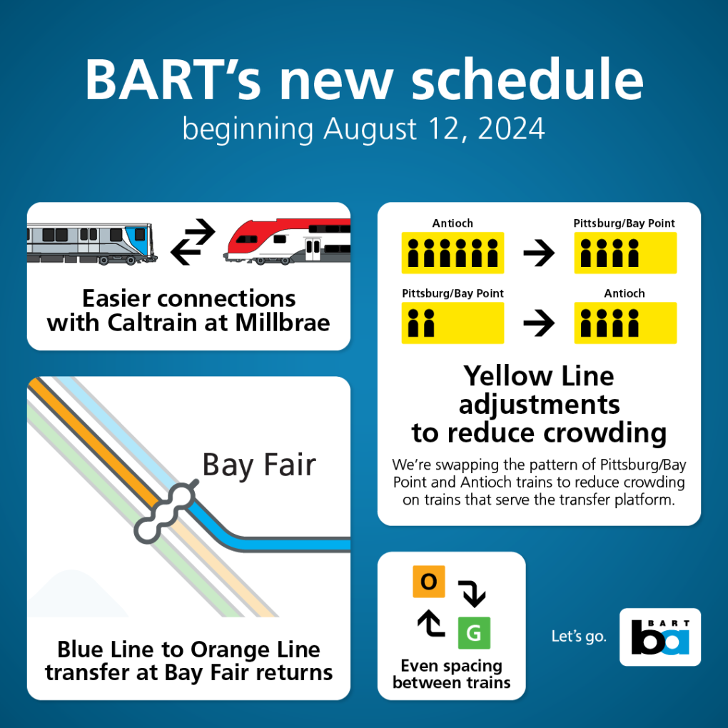
BART is making minor changes to the schedule beginning Monday, August 12, 2024, to improve key connections and to provide less crowding by better spacing of trains.
Some departure times have shifted by a few minutes, and we encourage riders to check the schedule before August 12th to see if their trip is impacted.
The BART Trip Planner has been updated with the new schedule so riders can start planning their trips using the date August 12, 2024, and beyond. PDF timetables of the new schedule are posted below. BART shared the new schedule with all partner transit agencies in March 2024 to give time for them to ensure schedules are aligned and transfers are timed as best as possible. All Bay Area transit agencies are working together to advance schedule bid alignment (in August and January) as part of efforts to improve transfer timing across the region.
Yellow line adjustments
While the intervals between trains will remain at 8 and 12 minutes, we are swapping the pattern of Pittsburg Bay Point bound and Antioch bound trains to ease crowding on the trains that serve the transfer platform.
Even spacing on Orange and Green lines
Riders on the Berryessa line will experience better train spacing than ever before. The Green and Orange line will still run every 20 minutes, but trains serving the Berryessa line will now be evenly spaced 10 minutes apart. This reduces crowding and offers an option for riders every 10 minutes for those willing to transfer to complete their trip.
Blue to Orange line transfer improvement at Bay Fair
BART will bring back the connection from the Blue line to the Orange line at Bay Fair. In the September 2023 schedule change, riders coming from Dublin and travelling towards Richmond were hit with a 17-minute wait at Bay Fair to make the Blue line to Orange line transfer. Instead, riders were given the option of a very tight transfer opportunity at West Oakland to a Red Line/Richmond train. The much easier connection at Bay Fair will return on August 12th.
BART and Caltrain schedule coordination at Millbrae
Both BART and Caltrain will make changes to improve some of the transfers at Millbrae. The improvements will go into effect when Caltrain launches its electric service on September 21. With BART’s schedule change in August and Caltrain’s schedule change in September, ~85% of all weekday trains will have a transfer between 5 and 19 minutes at Millbrae Station. On the weekend, ~90% of trains will have a transfer between 5 and 19 minutes.
5-19 minutes allows for both systems to be off schedule a bit but still provide a reliable connection. If trains were scheduled with less than a 5-minute wait, delays would frequently break the transfer and result in a longer wait.
Transfers at Millbrae don’t always line up perfectly because Caltrain has four trains per peak hour and two trains per off-peak hour/weekends. While BART has three trains per hour at all times. Both systems are also limited in flexibility due to key system timing points elsewhere.
Transit Coordination
Bay Area transit agencies are syncing schedules in a whole new way with a focus on improving transfers between systems and making schedule changes at the same time. Agencies convened a meeting in March 2024 to share planned changes for mid-August and to look for opportunities to improve transfers. Advancing schedule change alignment is a key priority for Bay Area transit general managers who meet on a weekly basis to make transit more rider-focused and efficient. The major agencies are already working on another iteration of a coordinated schedule change to go into effect in January 2025. These coordinated schedule changes will benefit current transit riders while attracting new riders. Read more about these efforts and see details of the August improvements.
Early Bird Express Bus Service
On August 12, 2024 the following Early Bird Express bus trips served by AC Transit will be eliminated:
| Eliminated Route | Origin/Destination | Operator | Time | Alternatives |
| 706 | Bay Fair to Salesforce via 19th St. | AC Transit | 4:21am | 4:04am 703 bus* 4:45am BART train |
| 707 | Fremont to Salesforce | AC Transit | 3:50am | 4:55am BART train |
*The 703 AC Transit bus from Dublin/Pleasanton Station to Salesforce Transit Center will now depart at 3:47am and will now serve what was previously the 706 with a stop at Bay Fair at 4:04am, then at Fruitvale at 4:20am, then arrive at the Salesforce Transit Center at 4:40am.
View the Early Bird Express page for complete service information.
PDF Timetables
Weekdays
August, 12 2024 Weekday Service for Antioch to SFO (Yellow) Line.pdf
August 12, 2024 Weekday Service for Berryessa_N San Jose to Daly City (Green) Line.pdf
August 12, 2024 Weekday Service for Berryessa_N San Jose to Richmond (Orange) Line.pdf
August 12, 2024 Weekday Service for Dublin_Pleasanton to Daly City (Blue) Line.pdf
August 12, 2024 Weekday Service for Richmond to Millbrae + SFO (Red) Line.pdf
Weekends
August 12, 2024 Weekend Service for Antioch to SFO (Yellow) Line.pdf
August 12, 2024 Weekend Service for Berryessa_N San Jose to Daly City (Green) Line.pdf
August 12, 2024 Weekend Service for Berryessa_N San Jose to Richmond (Orange) Line.pdf
August 12, 2024 Weekend Service for Dublin_Pleasanton to Daly City (Blue) Line.pdf
August 12, 2024 Weekend Service for Richmond to Millbrae + SFO (Red) Line.pdf
*This article was posted on July 22, 2024
Bay Area history reclaimed: The story of 95-year-old artist Janet Bennett and her longstanding tile artworks at 16th and 24th St. stations
Note: Janet Bennett’s tile murals have come to define the character of BART's Mission District stations, and yet, in the fifty-plus years since the tiles were placed, her contribution has gone unattributed...This Women’s History Month, BART is honored to bring forward the story of the artworks as well as that of the wonderful midcentury artist who made them.
BART will be installing plaques at 16th St. Mission and 24th St. Mission stations to recognize Bennett as the artist behind the character-defining murals.

Janet Bennett, the artist behind the tile murals at 16th St. and 24th St. Mission stations, seated in front of one of her paintings in her New York City home.
Every day, thousands of people pass through BART’s Mission District stations in San Francisco. As they enter the fare gates, walk along the concourse toward the stairs, then onto the platform to await their trains, they are walking through history.
It’s a history wrought by many hands over more than five decades: the planners who mapped the system, the architects and engineers who drafted the plans, and the workers who sweated day by day to construct a transit space that would function not just during their lifetimes, but the lifetimes of their children, grandchildren, great-grandchildren, and so on.
BART stations serve a practical purpose, of course. But they are not solely utilitarian spaces. Stories are woven into their floors, their trackways, and their walls. These individual components speak together and alone, and if you take a moment to pause and investigate, they might reveal the stories they contain.
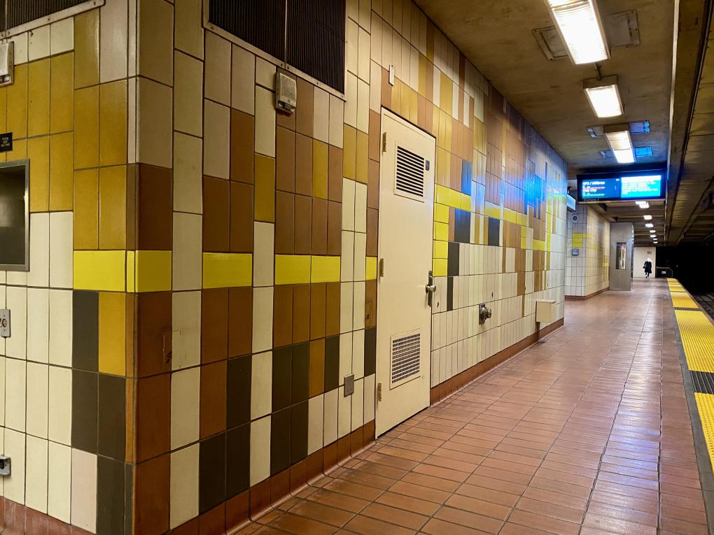
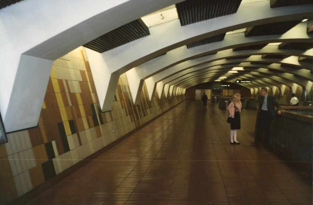
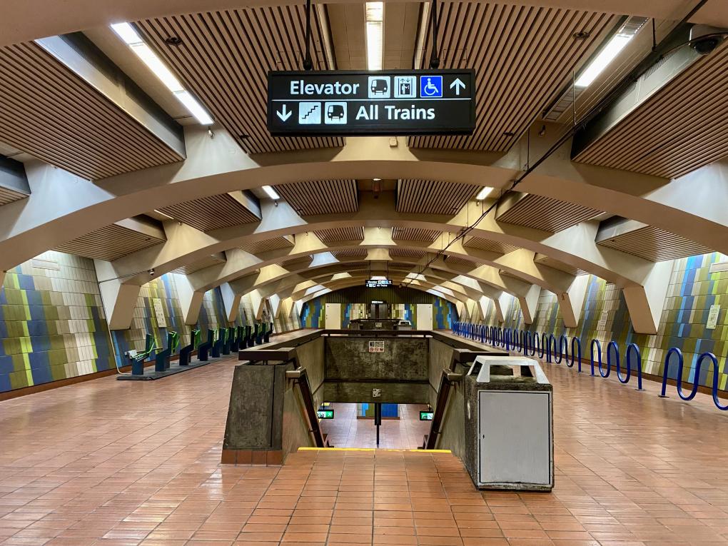
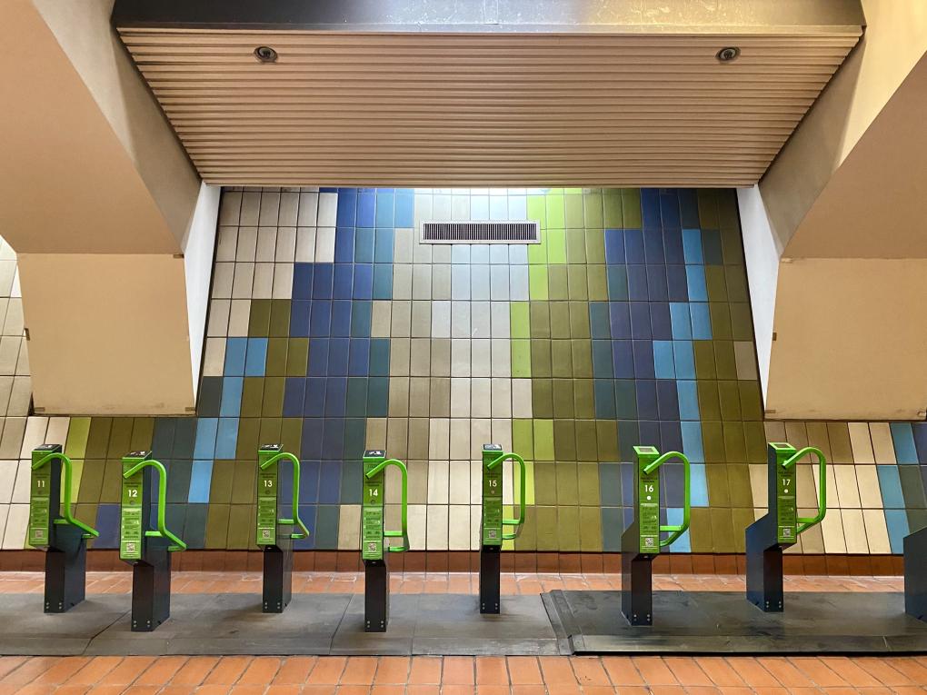
Artist Janet Bennett, now 95 years old and long retired, is a protagonist in the story of 16th St. and 24th St. stations. During the construction of these transit spaces, Bennett was hired by the station architect, Hertzka and Knowles, to design the striking tile murals on the stations' concourse and platform walls. Next time you’re passing through, look around and you’ll find you are surrounded by her tile artworks, from the snaking yellow formations on the platform at 24th St. to the tree-like waves of green and blue that dance on the concourse at 16th St.
“It’s gratifying that these works are still a part of people’s lives,” said Bennett, speaking from her New York City home. “They’ve gone through different lifespans so to speak. I’m happy that my tiles remain and that they’ll be there quite a while longer.”

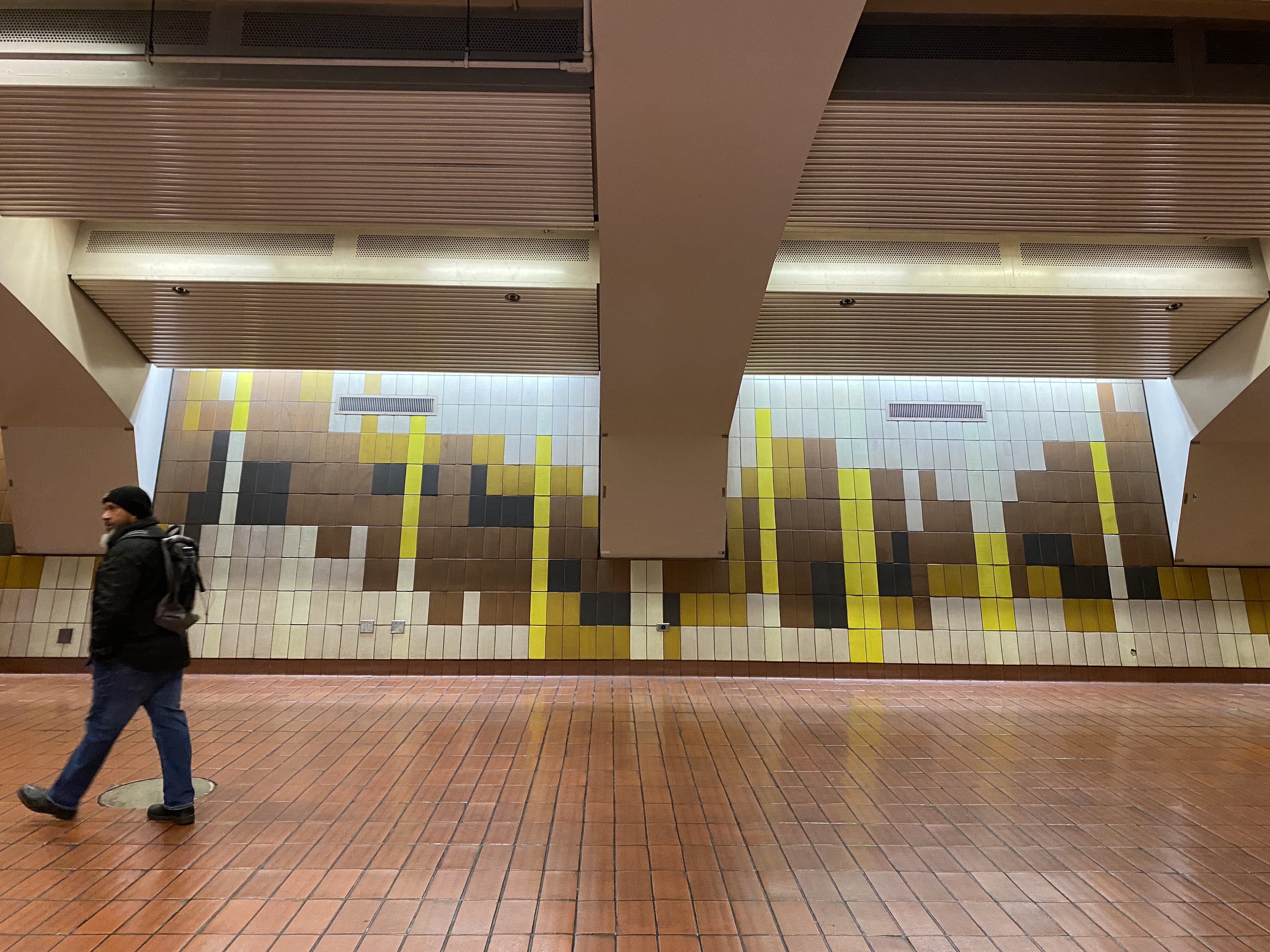
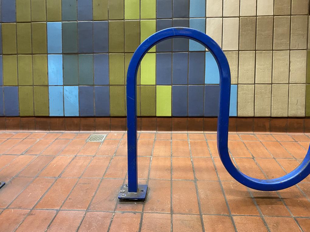
Bennett's tile murals pictured on the concourses at 16th St. (top photo) and 24th St. (bottom photo).
Bennett’s tile murals have come to define the character of the Mission stations, and yet, in the fifty-plus years since the tiles were placed, her contribution has gone unattributed. Said Jennifer Easton, BART’s Art Program Manager: “As a woman and someone who works with artists all the time, it’s so common to see women artists obscured throughout history.” BART learned about Bennett and her connection to the Mission stations after her daughter, Maria McDonald, called BART Customer Services and told them that “my 95-year-old mother named Janet Bennett should be credited as the designer of the ceramic tile artworks at 16th and 24th St. stations.” She added: “It means a lot to her.” BART verified McDonald's claim via 1971 news clippings from local papers.
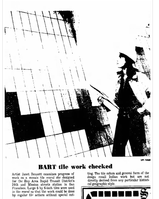
This Women’s History Month, BART is honored to bring forward the story of the artworks as well as that of the wonderful midcentury artist who made them.
“She really is a creative genius in my estimation,” said McDonald.
When Bennett was working as a staff and consultant for architectural firms and corporations in the 60s and 70s, she “was constantly breaking the glass ceiling and unconsciously taking on the lead in roles usually reserved for men,” her daughter said.
Bennett acknowledged that during that period, she was the only woman working for these major architecture firms outside of the secretarial staff. Even before then, when she was a student at Cranbrook, an art and design school in Michigan, Bennett said “no one expected that I would be anything but an architect’s wife.”
“It didn’t bother me at the time,” she said. “I was just doing my thing.”
(A relevant side note: Bennett also designed the famous mosaic passages at LAX, and her boss at the time, Charles Kratka, was long credited as the artist behind the works. Bennett set the record straight in 2007 after reading an obituary for Kratka that named him as the designer. She is now widely credited as the artist behind the mosaics. The artistic similarities between the LAX murals and the BART works certainly reinforce her claim.)
When the station architect contacted Bennett about designing the tile murals, she said she was “very, very excited.” Much anticipation and curiosity swirled around this new “Space Age” transit project, and Bennett was intrigued by the idea of leaving her mark on the system.
Upon accepting the assignment, Bennett got to work in her San Francisco studio outlining on paper the concepts for the murals. Once the initial designs were greenlit by the architect, Bennett executed the working drawings, which indicated the placement of every single tile. It was a lengthy and painstaking process.
Bennett said the designs at each station intentionally contrast with one another – there’s the dry, sunny feeling at 24th St. with its terra cottas and yellows and tans, and then the cooler tone of 16th St. with tiles of olive and gray and yellow green.
“One mural is more earthy, while the other is more sylvan,” she said. “Those concepts helped me create the overall program.”
Bennett’s artworks often reference “something from life,” and in many cases, she lets the colors and their relationships to one another inform her pieces. For 24th St., she referenced the vibrant hues of the Mission District and its close cultural ties to Latin America. The horizontal tiles that wrap around the core structures on the platform represent a yellow serpent, she said.
At 16th St., Bennett was influenced by visits to Marin County, its singular “forests, grasslands, and water.”
"Overall, the concern was that the colors worked well together,” Bennett said. “Part of it was motivated by a feeling that I wanted to express."
Bennett frequently traveled to Marin to meet with the tile maker for the project, the historic Heath Ceramics, which was and still is known for its unique glazes and handcrafted tiles. Heath Ceramics was founded by Edith Heath in 1948 in Sausalito, and its architectural tile line had gained acclaim with many architects throughout California by the time Bennett was working in the industry. Bennett said she collaborated closely with Heath to create the color palette for the BART station tile glazes, which she believes were custom made for the project.
Ceramic tiles are expensive, but you will notice that many BART stations incorporate them. That's because the material is durable, easy to clean, and conveys a sense of handcraftmanship, much like the use of wood, unique concretes, marble, and other unique architectural finishes used in the early BART stations. Bennett’s longstanding tile murals are a testament to the durability and timelessness of these materials.
The large ten-inch tiles Bennett used for her project added to its cost, she said. Because they were so large, the tiles sometimes warped during the firing process and had to be tossed out.
The architects of the stations also had something of a bone to pick with Bennett’s decision to use a horizontal tile layout on the core structures of the platform at 24th St.
“The architects said the horizontal tiles complicated the overall layout, and therefore were too time-consuming and costly to use. They said I should change my working drawings,” Bennett said. “I countered that it would cost more to redraw them."
“So,” she said triumphantly, “the horizontal tiles remain.”
After perfecting the drawings and selecting the last tiles, Bennett finally handed the project to the tile layers. The workers installed the tiles one at a time with special care and attention. Their skilled work in tandem with Bennett’s amaranthine designs has ensured that these murals will remain for many years to come.

A portrait of the artist.
Bennett has left a mark on many public spaces, including those in the Bay Area where she lived for a time. She said she created works for a variety of local institutions: metal mobiles for the Ice House, a longstanding set of buildings in San Francisco’s Waterfront District; an illuminated acrylic and steel sculpture for Memorex, considered to be one of Silicon Valley’s first tech startups; and even a stage set for a San Francisco Opera gala.
Back in the 60s and 70s, Bennett said her artworks were mostly considered “decorative” because of their functional usage in architectural settings. She thinks the term demeans her work and its artistic value.
“I didn’t think of my work as merely decorative,” she said. “Heck, [by that definition] Michelangelo ‘decorated’ the Sistine Chapel. It’s applied art made to enhance a space and give dignity to it."
Many of Bennett’s artworks have disappeared in time, just like the buildings and businesses that housed them. But she recognizes that "often art is here one day and gone the next.”
“Artwork has its moment,” she said, “and sometimes that’s it. But artwork as part of architecture can exist for centuries.”
Though Bennett’s art practice mostly consists of painting these days, she says she’d consider taking on another mural commission if the right project came along.
“If somebody contacts me because of this article, I could certainly do this type of work again,” she said. “I don’t have the strength to set the tiles, but I certainly have the strength to design some murals.”
The Transbay Tube turns 50: Inside the groundbreaking history and future of the Bay's underwater crossing
An Engineering Marvel: "Nobody has a tube like ours"
September 16, 1974, was a banner day in the history of the Bay Area. On this day, 50 years ago, BART’s Transbay Tube opened for passenger service.
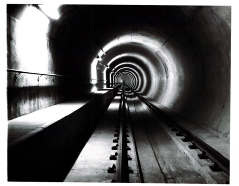
The 3.6-mile-long Tube was unlike anything the world had ever seen. At the time, it was the longest immersed tube in the world, a title it held until 2010, and it mystified the public, who were mesmerized by the idea of a miles-long structure sitting 135 feet below the water’s surface. To some, it was a preposterous notion – train rides under the ocean?!? -- but the nonbelievers quickly hushed on that fateful day in 1974. They, too, wanted to take an underwater voyage from Oakland to San Francisco.
This is the story of a modern marvel – its past, present, and future. It is also a story about people – those who ushered the Tube into existence and those who are still working to ensure it stands for generations to come. Long after all of us have departed this earth, the Tube will remain.
On the Transbay Tube’s 50th anniversary, BART honors this one-of-a-kind structure that has ferried millions of passengers across the Bay for five decades and will continue to do so for decades to come. In the above video, we invite you to look inside the engineering opus for yourself.
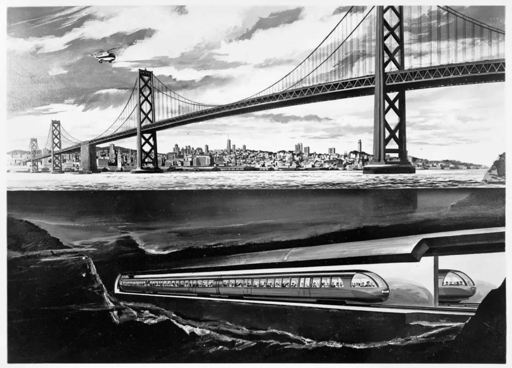
1961: The first concept drawing of the Transbay Tube.
It was 1973 when budding actor Kenny Meyers got a job power washing the Tube to prepare it for its public debut. After that first gig with BART, Meyers never left. He retired from BART after 48 years in 2021.
Meyers still remembers showing up to that first interview in a suit and tie, not totally sure what position he had applied for. He needed a job and didn’t care much what it entailed.
“During the interview, the supervisor asked one question: ‘Do you have jeans?” Meyers remembered. “When I nodded, he said, ‘Great. Wear ‘em tomorrow and show up here at this time.’”
Meyers did as he was told, and after a month as a utility worker, he was sent to the Tube with a fellow worker and a 300-foot hose. Their task: wash the dusty walls before the structure’s premiere.
"At the time, I didn’t know anything about the project,” said Meyers. “We were looking at each other going, what is this thing? At 20 years old, it was an eye-opening experience. That’s when I realized how crazy engineering is.”
Not many people have had the chance to see the Tube where it lay – only specially trained divers who can navigate the zero-visibility waters and perhaps the ghosts of long-ago shipwrecks. It’s not just mud and muck down there, though there is plenty of that. There are waves of sand – not unlike the dunes on land – deep holes, and huge mounds of rock. Sharks, whales, porpoises, fish – all the creatures that call the Bay home – float above this feat of engineering that sits 135 feet below the surface at its maximum depth.
It’s another world down there, and it’s in this world one is zooming through at 70 miles per hour when riding a BART train from Oakland to San Francisco.
Most of us aren't paying a lot of attention when we make this familiar voyage. We’ve got things to do, phones to scroll, books to read. The exception may be the many generations of children mesmerized by the quick trip through the ocean’s depths, their eyes glued to the windows in the hopes of seeing a leopard shark or a playful seal.
The Tube isn’t translucent, and if it were, you wouldn’t see anything that deep in the water anyways. But in 1974, not long after the Tube opened, Meyers wanted to make a couple of kids’ day.
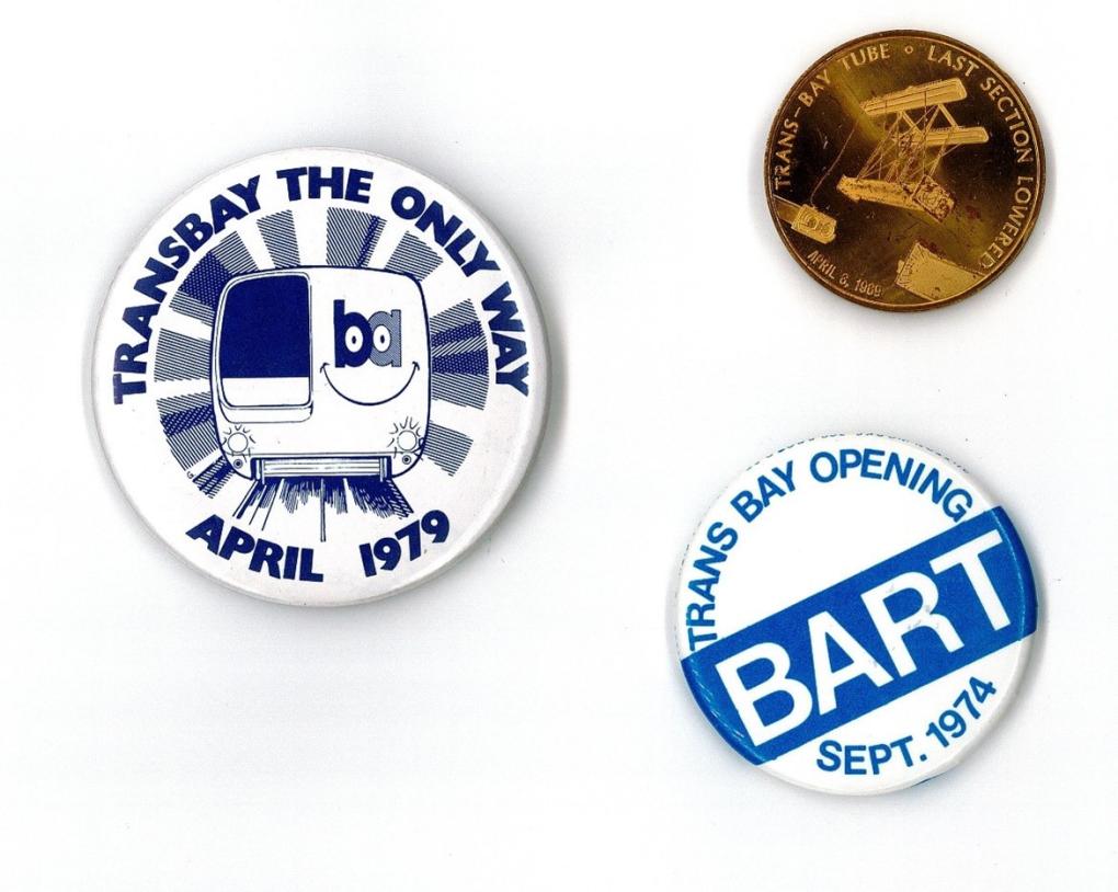
Various Transbay Tube mementos are pictured.
He got his chance one afternoon when a train came to a halt right in front of a vent in the upper gallery of the Tube, where Meyers happened to be standing.
“I pushed my face right up to the vent and made a face like I was swimming,” he said. “The kids screamed! They really thought I was swimming down there.”
Back when the Tube first opened, Meyers said people thought of it like Disneyland’s Monorail or its submarine ride, where you look out the windows and see all the animatronic mermaids and fish flapping around.
“People would ride it like they were at an amusement park, just for fun,” Meyers said. “It was one of a kind! It was over the top!”
“There's nothing really down there, though. No Starbucks or anything,” Meyers clarified. “Maybe I should push for that...”
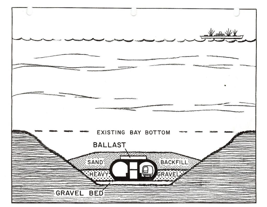
A drawing of the cross-section of the Tube in the San Francisco Bay.
The diagram of the Tube is pretty simple when it comes down to it (at least it looks that way). There are two bores, each with one trackway. Trains move west from West Oakland Station through the right bore (when looking from Oakland) and east from Embarcadero Station through the left bore. It’s not visually dissimilar to a giant pair of super long-lensed binoculars.
Between the bores there is an upper gallery and a lower gallery for pedestrian access, ventilation, and utilities. Workers use the galleries to get around the Tube, as evidenced by Meyer’s prank, sometimes on specialized vehicles that are akin to narrow golf carts. There are also bicycles on hand in case a cart loses its charge. Or you can make the trek back to land by foot.
BART staff enter the tube via five-story vent structures located on either end. Once you descend, you either start walking, cycling, or hitch a ride on a cart. There’s nowhere to go but through or back where you came from.
What’s it like down there? Pretty dark, for one, and despite cleanings, it’s a bit grimy thanks to all the brake dust from the trains. It’s also blustery due to fans that are constantly circulating air – you better be hanging onto your baseball cap if you get too close.
Then there’s the motion of the trains coming in and out. “When the trains come through, there’s wind blasting through the cracks of the gallery doors,” Meyers said. “Once it leaves, there’s a suction effect. A train in a Tube is not unlike a piston.”
Meyers added that the Tube has a very specific smell that he can’t quite place his finger on. “But after I get out of there, I’d smell like it for a week.”
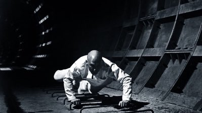
The Tube isn’t a Disney creation, but there's magic inside, especially when you’re zooming through in the front cab or the very end of a train. In the latter scenario, thanks to the glow of the brake lights, you feel like you’re passing through giant scarlet smoke rings, bigger than any talking caterpillar could blow, as you move through each of the structure’s 57 segments.
By the way, Kenny Meyers isn't the only actor whose hung around the Tube. In 1971 while the structure was still being built, George Lucas filmed a scene for his first feature film, THX 1138. In the film, Robert Duvall is shown climbing "up" from the subterranean Orwellian world, but he's actually crawling horizontally through the Tube. The structure has also appeared in Predator 2, Eve of Destruction, Eye for an Eye, The Shannara Chronicles, and an episode of Nash Bridges, among others. Its sounds were even in the videogame Dead Space.
I. An Underwater Bay Crossing is Born
With zero fictional embellishments, the Tube is as fantastic as something Ray Bradbury or Philip K. Dick might envision. So, we’re left with the question: How did BART bring this crazy thing from the realm of imagination into the realm of reality?
You could say it started with San Francisco’s beloved eccentric Emperor Norton. In 1872, the man who proclaimed himself “Emperor of the United States” issued a proclamation proposing the idea of an underwater rail tunnel that would cross the San Francisco Bay. A few months later, he made another proclamation threatening to arrest Oakland and San Francisco leaders who rudely ignored his initial request.
“Believing Oakland Point to be the proper and only point of communication from this side of the Bay to San Francisco, we, Norton I, Dei gratia Emperor of the United States and Protector of Mexico, do hereby command the cities of Oakland and San Francisco to make an appropriation for paying the expense of a survey to determine the practicability of a tunnel under water; and if found practicable, that said tunnel be forthwith built for a railroad communication.”
- Emperor Norton’s Tunnel Proclamation of May 12, 1872
Fast forward to 1947, and Emperor Norton’s grand designs were finally being put into play. That was the year a joint Army-Navy Commission issued their recommendation for an underwater Tube to relieve traffic congestion on the ten-year-old Bay Bridge. Even then traffic was terrible, despite the relief provided by Key System streetcars that ran on the lower deck of the bridge until 1958.
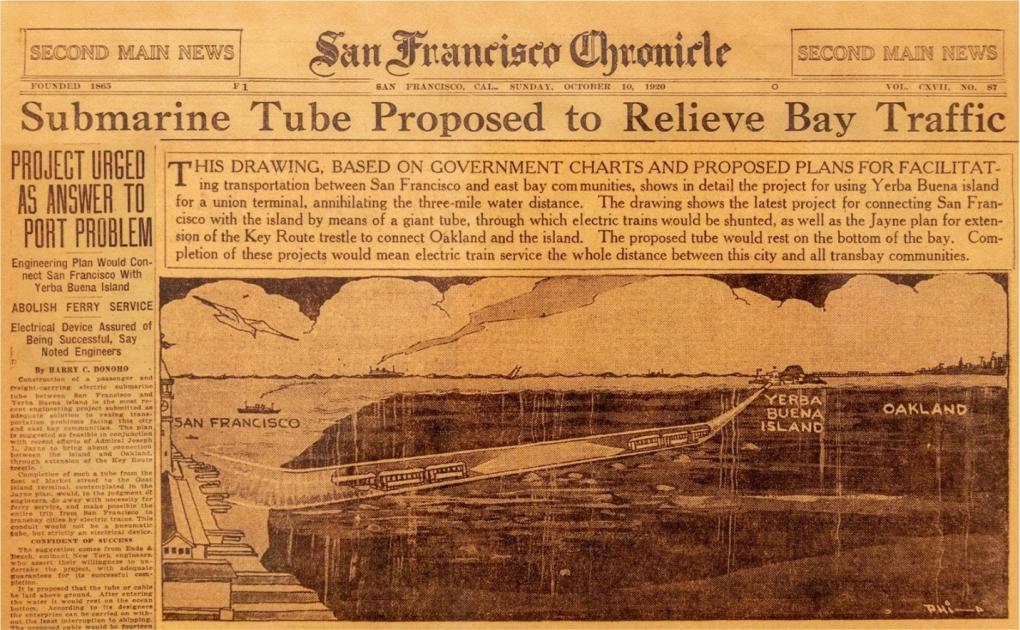
A copy of the front page of a 1920 San Francisco Chronicle.
After multiple seismic studies, a soil investigation program, and even the installation of an earthquake recording system on the floor of the Bay, a preliminary route was selected that would avoid as much bay bedrock as possible. Actually, the route wasn’t that far off from the one Emperor Norton initially proposed. The cost of the project was estimated at $132,720,000 (or about $1.4 billion in 2023 dollars) and was to be financed by toll revenues.
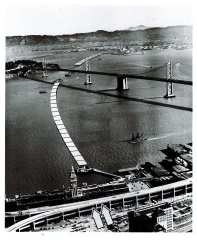
Top image: The route of the Transbay Tube depicted by the square dotted line in a photograph taken during the final stages of construction.
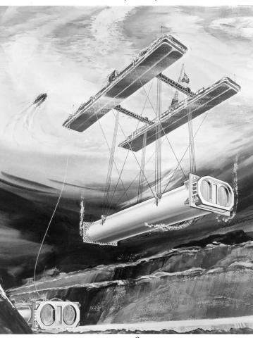
Bottom image: 1967: A concept drawing demonstrating how the Transbay Tube would be deposited on the floor of the Bay.
Construction began in 1965 as a joint venture of Peter Kiewit Sons’ Co.; Raymond International, Inc.; Tidewater Construction Corp.; and Healy-Tibbitts Construction Co. Together, they were known as the Trans-Bay Constructors. They kicked things off with a Tube groundbreaking ceremony in 1966 that featured a literal boatload of dignitaries watching a dredge bring up the first of more than 5.7 million cubic yards of Bay mud. It was groundbreaking in every sense of the word.
The contract called for a demanding two-and-a-half-year deadline for completion of the basic structure, so the Trans-Bay Constructors developed a fierce schedule at a pace of building and placing two Tube sections a month. There simply wasn’t time to make mistakes.
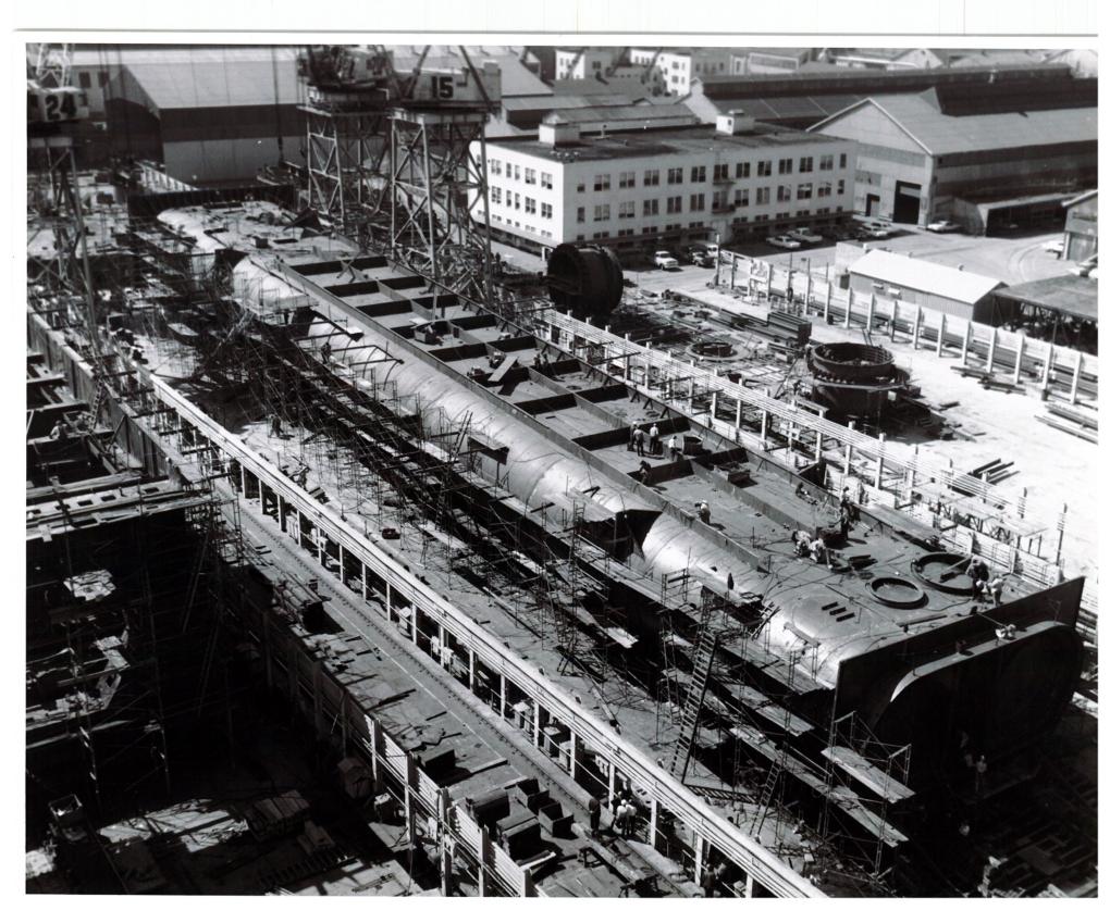
A photo of a section of the Tube under fabrication at Bethlehem Shipyards in South San Francisco.
The Tube is made up of 57 sections, each averaging 330 feet in length. The segments were fabricated at Bethlehem Shipyards in South San Francisco, from which they were launched, towed into the bay, and then sunk into their proper positions.
To get the just barely buoyant segments to the bottom of the bay, each was weighted with 500 tons of gravel ballast. One section weighed approximately 10,000 pounds, about 1/6 of the weight of a BART car. Lowering one segment required a complex system of hydraulic controls and strain gauges that allowed operators to monitor the weight distribution and keep each section level during descent.
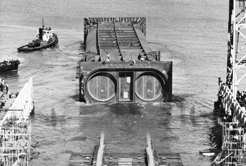
Circa 1969: A section of the Transbay Tube being floated into the Bay.
Divers were waiting at the bottom of the bay to direct the segments into exact position. When they surfaced, the divers climbed into two decompression chambers on the barge. It wasn’t 20,000 leagues under the sea, but it was still pretty darn deep.
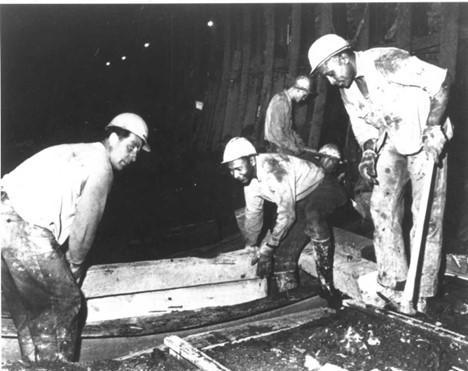
Concurrently, the trench for the Tube continued to be excavated. About 5.7 million cubic yards of material were removed from the bay. To keep the trench precisely aligned, engineers installed lasers from different shore positions that pinpointed the exact position required for the dredging barges.
In the end, the contractors met their schedule. The last section of the Tube was placed just east of Yerba Buena Island in 1969. Later that year, BART held an open house on both sides of the Bay, inviting members of the public to walk through two sections of the Tube. It was reported that the line to get inside stretched more than a mile.
With the segments in place and any stragglers cleared, the next tasks were laying the track, electrification, and installing the train control equipment and ventilation. The process took about four years, and in August 1973, the first train traveled through the Tube. About a year later, trains were carrying their first passengers across the bay.
Come 1974, the original BART system was officially complete.
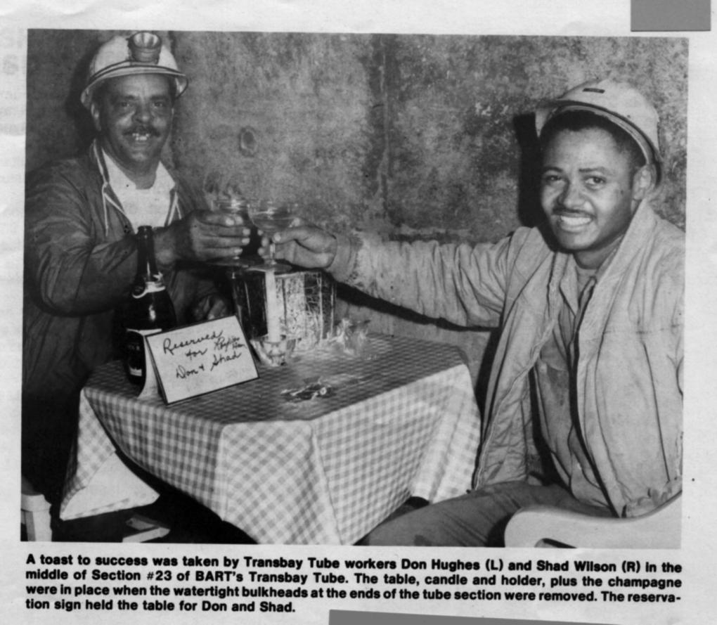
Tube sections were built from both the San Francisco and Oakland sides. When the last bulkhead was removed to finally connect the Tube, workers from the San Francisco side found Oakland-side workers Don Hughes and Shad Wilson enjoying champagne together.
II. Loma Prieta: "BART's Finest Hour"
The Tube was just a teenager, barely old enough for a driver’s license, when it was put to a terrifying test. On Oct. 17, 1989, the devastating Loma Prieta earthquake shook the San Francisco Bay Area and Central Coast for eight to 15 seconds, depending on where you were located. Sixty-three people died and 3,757 people were injured. In the aftermath, among other impacts, 12,000 homes and 2,600 business were damaged; the Cypress Street Viaduct on Interstate 880 collapsed; and about 1.4 million people lost power, temporarily knocking radio and tv stations off the air.
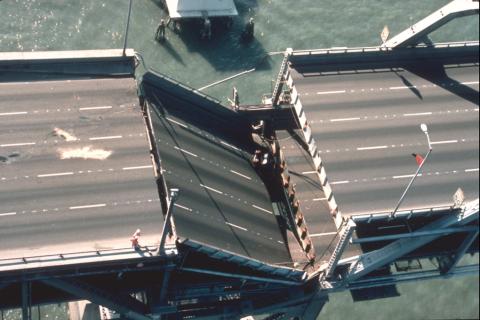
Then there was the San Francisco-Oakland Bay Bridge. A 76-foot-by-50-foot section of the upper deck fell onto the lower deck, causing severe damage and one fatality. The bridge is pictured after the earthquake (image courtesy of Flickr).
"There were reports of the bridge being down, flooding and fires in the city, we knew it was serious,” said Frank Wilson, BART General Manager at the time of Loma Prieta, in a 2014 interview with BART. “We thought, 'If the damage was that severe around us, what has BART sustained?' It was all hands-on deck to assess safety and find out how we were going to get back into service."
At the same moment Loma Prieta started shaking the Bay, Donna “Lulu” Wilkinson was operating a train at 80 miles per hour through the Transbay Tube.
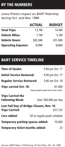
“I didn’t even feel it,” she said in a 2014 interview. She was halfway through the Tube when the Operations Control Center gave the order to stop and hold position. Passengers didn’t panic because they were accustomed to short holds in the Tube – standard operating procedure even for minor earthquakes. Most of them didn't notice a thing.
“The Tube absorbed the shock,” Wilson said. “When the engineers and planners first built the system, they were criticized by some from the outside that it was too expensive and unnecessary. But how much is a life worth? How much was it worth to keep people moving between Oakland and San Francisco?”
Calls began flooding into the Operations Control Center from employees asking for earthquake assignments, while those on the job gathered their wits and began inspecting the system from top to bottom for damage. Incredibly, damage was minimal, and less than 12 hours after the earthquake hit, BART service resumed.
Loma Prieta and the weeks that followed are often referred to as “BART’s finest hour,” and with good reason. Staff quickly jumped to take on extra shifts so BART could run 24-hour service in the Transbay Tube, which started the day of the earthquake and ended December 3. The Bay Bridge did not reopen until November 18.
Said Wilson: “Not only did they get BART back on track, they kept it there for more than a month while the Bay Bridge was out of service, carrying more than 10 million passengers to their jobs and homes around the clock.”
III. The Earthquake Retrofit: “Like doing open heart surgery every night then bringing your patient back to life, over and over and over again”
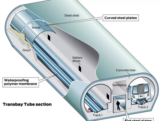
A diagram of the Transbay Tube that shows the outer steel shell, concrete liner, and steel plates that line the Tube’s interior.
Loma Prieta had a magnitude of 6.9. What would happen to the Tube in the event of a once-in-a-thousand-years earthquake?
This was the thought rumbling around the mind of Jim Dunn, BART’s then-Chief Engineer, when he instigated what became known as BART’s Earthquake Safety Program (ESP) in the early 2000s. The huge project was officially completed this year.
“Dunn knew Loma Prieta was not the worst-case scenario. He wanted to know if a real big one would give us a problem,” said Tom Horton, who was BART Group Manager of ESP before retiring in 2017.
With ESP, BART was not just preparing for a major earthquake, but one that might be centered closer to the core system, which runs directly adjacent to the San Andreas and Hayward faults.
On November 2, 2004, voters in Contra Costa, San Francisco, and Alameda counties approved Measure AA, which allowed BART to issue general obligation bonds to fund up to $980 million of the $1.4 billion total cost of earthquake safety improvements. The team hit the ground running. The Tube retrofit began years later, in 2017.
“We started with a major evaluation of the system and how vulnerable it was to earthquakes,” Horton said. When Horton started, he had three employees. At the height of the project, more than 100 people were working on the program, 30 of whom were devoted to ESP full-time.
“I have immense respect and appreciation for the personnel who worked on this,” said Zach Amare, BART Assistant Chief, Infrastructure Delivery. Nearly every department at BART had a role to play, including but not limited to the Operations Control Center, Traction Power, Track Maintenance, System Safety, Power/Mechanical Engineering and Maintenance, Operations Planning, Locomotive Operators, Operations Liaisons, Government and Community Relations, Communications, and many, many more.
He credits the project’s success to four things: dedicated BART personnel; executive management who offered full support from the get-go; skilled contract personnel “who were up for the challenge to solve problems”; and a cohesive project management team.
“Without these elements, this complicated, challenging project would not have been successful,” Amare said.
Chuck Bernardo, BART Group Manager of Capital Projects, said he “didn’t realize how one-of-a-kind the Tube was until I started working on it.”
“The challenge of the retrofit appealed to me,” he said. “You’re working at night and running the system the rest of the time. It was like doing open heart surgery every night then bringing your patient back to life, over and over and over again. You had to just dive right in. No one could tell you how to do it."
A key piece of the Earthquake Safety Project was the seismic retrofit of the Transbay Tube, deemed BART’s most valuable asset.
“It was the most difficult engineering project I have worked on with many unexpected challenges along the way, both in design and construction,” said Mark Salmon, who helped coordinate the retrofit design work for BART. "It really showed me the power of teamwork and perseverance. In many respects the Tube is unique in the world; there is no other similar example we could use to draw experience from and guide us. We had to solve the design and construction problems ourselves.”
We want to be very clear: The Transbay Tube is structurally sound, but we are preparing for a rare and devastating earthquake, defined as something that happens once every thousand years. In an event this large, the Tube won’t fail, but it could crack and leak.
“Underground structures in general are less of an issue because they don't see the same level of ground motion as the surface,” Horton said. “The wave is confined by the soil if it’s underground, but when it hits the surface, you get big movements.” As evidenced by the Tube travelers during Loma Prieta, the Tube may be one of the safer places to be during a big quake.
BART worked with earthquake retrofit specialists using a combination of geotechnical and structural site investigations, computer simulations, and testing of materials and models to develop the retrofit design.
Part of the modeling process including traveling to UC Davis, which has an old NASA centrifuge once used to train astronauts. Now, researchers use the centrifuge to simulate the pressures earthquakes could apply to buildings, and in our case, the pressures the Tube might face in a major shaker.
Back in the 1960s, engineers designed the Tube to flex with earthquake ground motions to dissipate earthquake forces and absorb shock. A stiff Tube would become brittle and break in an earthquake, so the “Tube wiggle” is crucial.
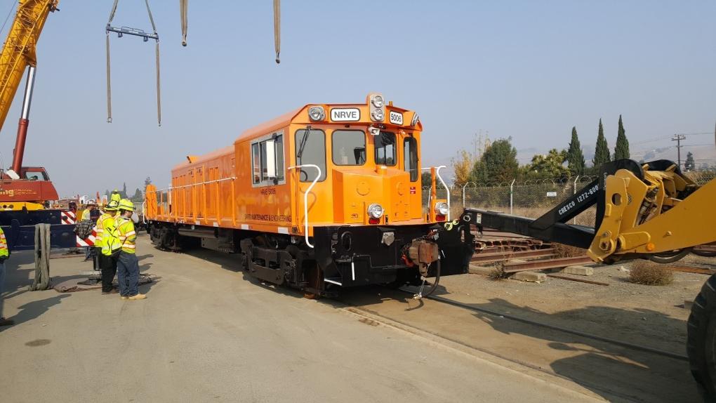
An image of one of three locomotives on the work train used during the Transbay Tube retrofit.
At both ends of the Tube, there are giant seismic joints that allow the two ends of the Tube to move independently without damaging the structure. During the retrofit, the original joints were modified to increase their movement capacity. Now, the two sides can “separate” further without major damage to the Tube.
On the Oakland side of the Tube, a steel liner was added to withstand the expected large forces this area could experience in an earthquake. The steel liner is both a structural fix and a means of preventing leakage.
"There could be flooding in the Tube due to a 1,000-year earthquake, but it would be slow enough that people could get out safely,” Horton said. As it turns out, the Tube is predicted to sustain very little damage in a 500-year earthquake event.
BART engineers addressed the potential for leakage after a severe earthquake with two elements. The first was to install the steel inner liner in the sections most likely to experience the largest movements. The second was an upgrade to the Tube’s pumping system to enable it to handle a higher volume of water and pump at a greater rate.
The steel plate handling machine deserves some special attention as it was crucial to the project.
The machine, transported into the Tube by a specialized work train (more on that below), placed steel plates fabricated to match the Tubes arched geometry. Once secured by concrete anchors, they were welded together. Grout was then used to fill the void between the existing concrete liner and new steel liner. A different method utilizing a plastic sheet membrane was employed on the Tube section supporting the trackway.
During the retrofit, every minute was precious. When Horton visited the steel liner operation during a work night, he said it ran “like a military exercise.”
"As soon as the work train arrived, workers got off and went right to work, each person knowing exactly what their job was and going right at it.”
Some workers put in 12-hour shifts, six days a week, to get the work done. This dedicated cohort includes Frank Greco, BART Structures Equipment Operator, who was one of the operators of the 800-foot, custom-built locomotive train.
“Working those long hours was a sacrifice, for sure,” Greco said. “But I felt like I was a part of something bigger than myself. The Tube is such a big part of BART. It’s something thousands of people travel through on a weekly basis. Just to be a part of that, I felt very fortunate.”
Greco said community sprung up around the painstaking work and the hundreds of hours they spent underwater. Often, the community was motivated by food. BART Operations Supervisor Harold Stuart would make regular Costco runs and bring giant boxes of snacks into the Tube for the workers. As Kenny Meyers said in the first half of this story, there’s no Starbucks down there.
Greco said his first trip into the Tube made him "trip out.”
“I loved it,” he said. “You’re in the middle of the water! It’s crazy! It’s unreal!”
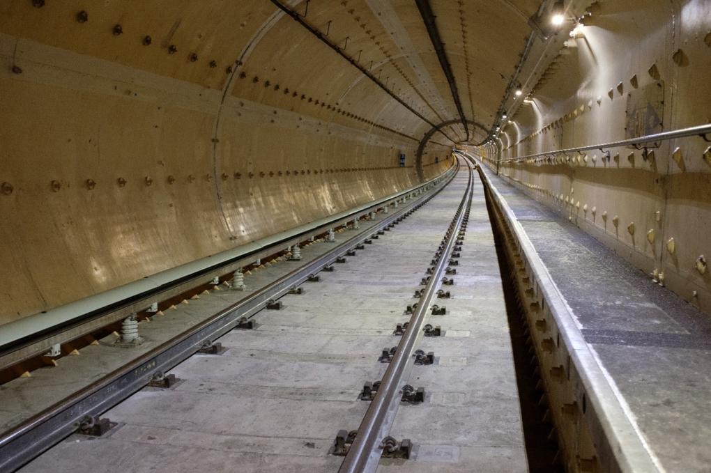
A photo of the completed retrofit inside the Tube.
Most of the time, Greco tried not to think about how deep underwater he was on those long graveyard shifts. It’s easy to psych yourself out down there, he said.
Will Sowell, Jr., BART Structures Equipment Operator, also served as a work train operator, and initially, he didn’t want to do it.
Sowell was used to big equipment, but not that big. The closest thing to the work train he’d operated was a power flat machine.
He and other work train operators received specialized training to operate the work train, which can hold up to three 50-foot-long flatcars, seven 40-foot-long flatcars, two 41-foot-long concrete cars, one 55-foot-long steel plate handling device, and one 40-foot-long plate handling device flatcar. Say that five times fast.
"The first time being on that machine was scary,” Greco said of the work train. “You know what you’re doing, but when you throw in the train with a lot of power and a braking system that’s intricate, it is a lot to handle.”
Greco said he got used to it quickly. “And at the end of the day, not a lot of people can say they’ve operated a huge train with 17 cars. That’s something to put on your resume for sure.”
Getting the job done in such a tight timeline took serious coordination and logistics.
Bernardo said the Contractor would work backwards to build each night’s work schedule. They had to ask questions like: How much concrete do I need? How many steel plates have to go up? How many anchors and ties do we bring?
“The project team and contractor were constantly thinking about how to work under the constraints of the Tube, Bernardo said. “As we worked backwards, we’d realize, oh, we can’t do this task because this is in the way. Then, if we remove that first task, we have to find a place to put it back in.”
Sowell witnessed these logistics in real-time. Every night before leaving the Oakland Yard, Sowell and his team would go through an extensive safety and supply check for the work train to make sure they had everything they needed, the cars were in the right order, all the equipment was secure, and the brakes, horns, bells, whistles, etc., were working properly. Then Operations Control Center would give the cue for the train to head out. Since work began at 9pm, passenger trains would share the tracks with the work train as it made its way underwater.
"Every aspect of this project was unique because the Tube is unique,” Horton said. There's just nothing quite like our Tube.
IV. BART’s Cathodic Protection System: “Without this system, the Tube would be gone by now”
The Transbay Tube is an underwater steel structure, meaning it is prone to rust. To extend the life of the tube, BART employs a cathodic protection system, which prevents this from happening using electrochemistry.
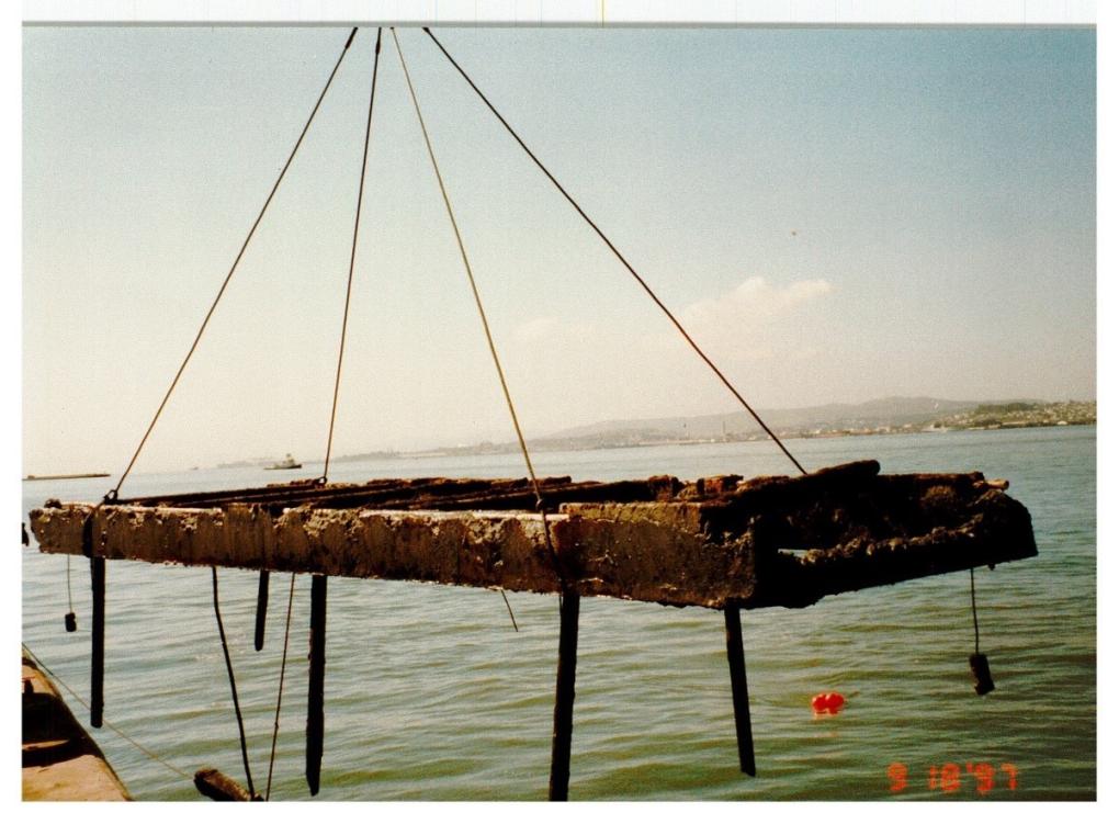
For BART's cathodic protection system, an external power source is used to push current from the anode sleds (an old, rusted anode is pictured in the first photo in the above slideshow) to the steel structure of the Tube, which acts as a cathode. The anode sleds sacrifice themselves (i.e. rust) to protect the cathode -- in our case the steel structure of the Tube.
There are a total of 30 400-pound anode sleds on the Tube, each containing16 anodes apiece. A huge wire connects the anodes to a power box contained within the Tube, which pumps 200 amps of current -- that's equivalent to the energy needed to power an entire modern home!
“Without this, the Tube would be rusted by now and require billions in replacement costs,” said Senior Manager of Engineering Programs Maansii Chirag Sheth, who oversees the cathodic protection system. And don’t worry about the marine life, she stressed. “If you’re a little fishy and you touch the Tube, you won’t feel the current. It’s not an electric current that’ll shock you.”
Maansii is one of just a handful of certified cathodic protection engineers in the U.S. The work is extremely specialized, and corrosion engineers must take a difficult certification test. Maansii passed the test in 2013. She was just the 39th person in California to receive the specialized certification.
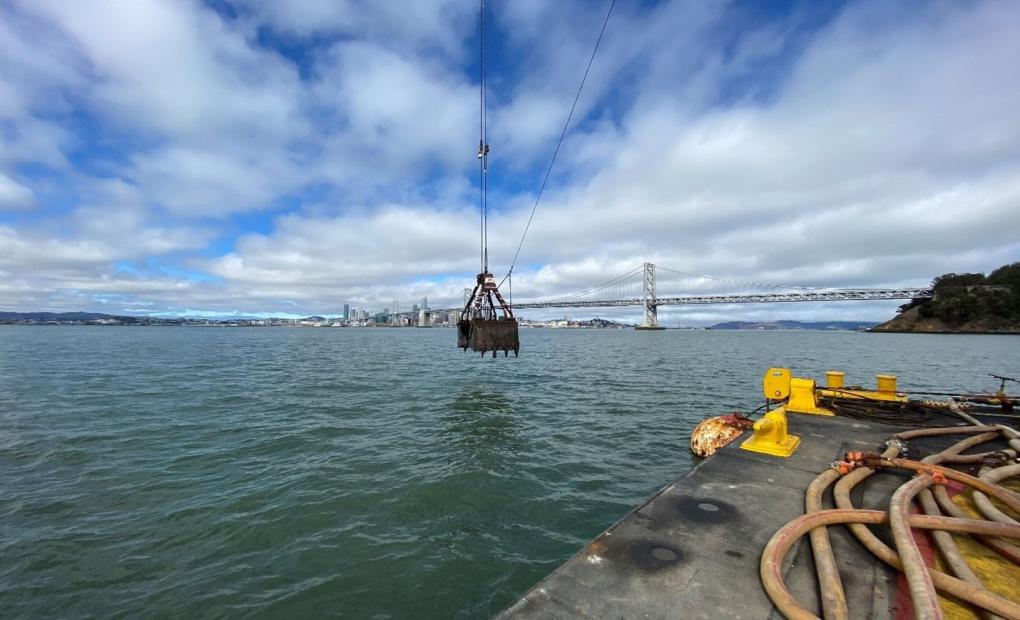
Large clamshell dredging bucket being lowered into the bay as part of soil handling operations.
Every few years, the rusted anodes must be replaced, and only a handful of contractors in the U.S. are equipped for this sort of specialized, largescale work, Maansii said.
Replacing a 400-pound anode attached to a Tube more than 100 feet deep in zero-visibility waters is a tall task, as you can imagine. Best-case scenario, the replacement of a single anode takes about a half a month. With shifting currents and wind, the anodes can move slightly, and down there, you can’t see a thing. The work is faster now that GPS systems have improved, which make it easier to locate the anode in the water.
“It’s a complex operation with a large amount of variables at play. You have to account for weather and seasons, contracting and securing a barge, hiring trained divers, leveraging specialized equipment, and obtaining permissions from the Coast Guard, and so on," Maansi said.
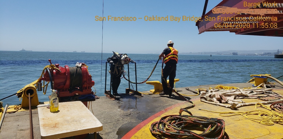
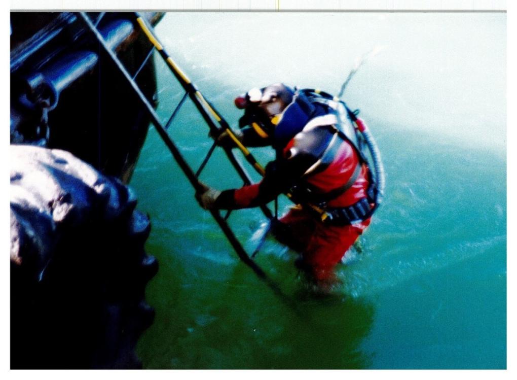
Diver stepping off barge into the Bay as part of cable installation operations near the Transbay Tube.
You also can’t work when it’s stormy or during certain months, including the entirety of Dungeness crab season. One must manage tide cycles, passing vessels, soil handling restrictions – the list goes on.
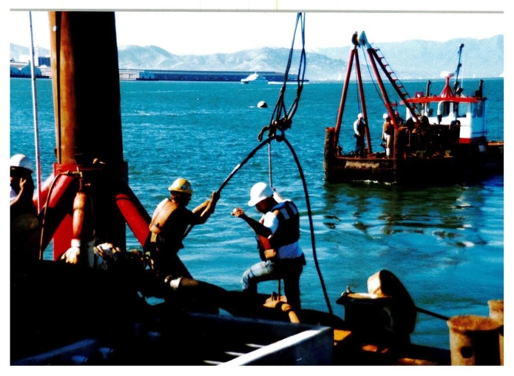
Once all that’s taken care of, it’s time to get down to work. First, a large clamshell bucket on the barge digs out a bunch of mud to expose the anode. Deep-sea divers specially trained for industrial projects pinpoint the exact location of the anode, which is detached then lifted from the water onto the barge. Then, the new anode is lowered down and attached to the cable system. After testing, the anode is energized, and its sacrificial work begins.
Let us all take a moment to thank the sacrificial anodes for their service. Without them, no Tube would be there and no connectivity in the Bay.
V. The Transbay Tube’s Next Chapter: “It could be under the Bay forever”
Though this story is coming to an end, the story of the Tube is far from over. The Tube is fifty, true, but we can’t say it’s hit middle age just yet.
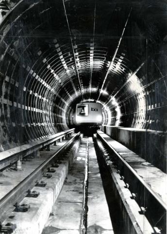
Thanks to the Earthquake Safety Program, those sacrificial anodes, and the many BART staff who work to keep it maintained, the Tube’s got quite a life ahead of it.
What might the future hold? Currently, BART is working on a project that will allow us to operate up to 30 ten-car trains per hour in each direction through the Tube, increasing capacity and shortening wait times at stations. Currently, a maximum of 24 trains per hour can travel through the Tube in each direction.
The program includes four elements: the purchase of additional railcars, a new railcar storage yard at the Hayward Maintenance Complex, a new communications-based train control system that will allow shorter waits between trains, and five additional traction power substations to provide the additional power needed for more frequent service.
It’s a bright future for a structure with a history long enough to fill the pages of a whole book. We’ll save that project for another day.
“Nobody has a Tube like ours,” said Horton in conclusion. “It could be under the Bay forever. That gives you something to think about.”
Entrance Closure Alert: Embarcadero Davis at Market Streets
September 6 update:
The closure has been extended to Sunday, September 15 due to unforeseen complications. We thank you for your patience.
----------------------------------------------------------------------------------------------------------------------------------------
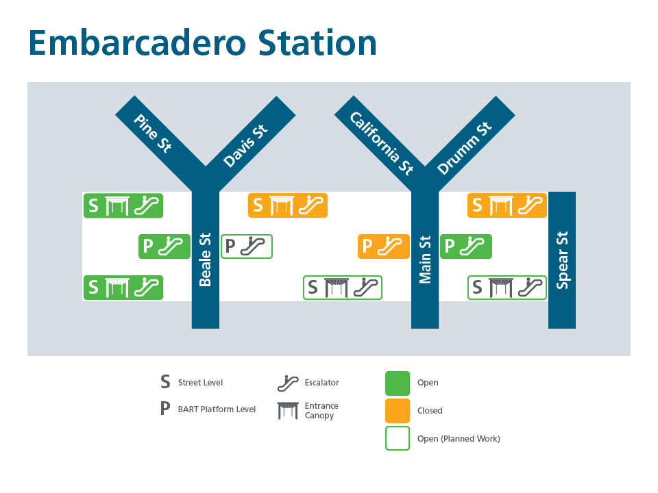
BART’s escalator contractor will close the Embarcadero Station entrance located at Davis and Market (stairway and escalator) this Friday, August 30 to Sunday, September 8. This full entrance closure is necessary to complete installation of panels at the entrance.
Please note there will be two entrance closures at the Embarcadero Station during this 10-day period. A map below shows the open entrances and elevator location. Wayfinding signs will be installed on the barricades inside the station and on the street level to detour pedestrian traffic from this entrance.
BART crews are busy working on the single largest contract for escalator replacement in BART history. The Market Street Escalators Renovation Project team is working to install and replace 41 escalators at Embarcadero, Montgomery, Powell, and Civic Center stations. Of the escalators to be replaced, 23 are street to concourse level and 18 connect concourse with station platforms. Project completion is expected to be in 2026. You can view the four downtown station maps for escalator and canopy progress at: https://www.bart.gov/about/planning/sf-escalators
Single Tracking Alert: Service to be reduced to one track between Balboa Park and Daly City for tree removal work (final Sunday workday cancelled)
Update 10:00am, September 13:
The final Sunday of scheduled work for this project between Balboa Park and Daly City has been cancelled. BART will now run its normal service on Sunday, September 24 instead of reducing service to one track.
On three non-consecutive Sundays in August and September BART will be cutting back and removing trees that could pose a hazard to the trackway between Balboa Park and Daly City stations. To ensure safe conditions for workers, service will be reduced from two to one track on the following Sundays:
*August 27
*September 10
*September 24
Riders in the area on those workdays should anticipate delays of 10-15 minutes. Also, all Green Line trains will be cancelled.
On those three dates BART will also perform tree removal work in southern Alameda County. That work will happen on both Saturdays and Sundays on those three weekends and will require free buses to replace train service between Union City and Fremont stations. You can learn more about the work in Alameda County here. You can also get more details about BART’s systemwide safety initiative to remove potentially hazardous trees at the project page.
Ashby Station: access impacts expected from bicycle connector project
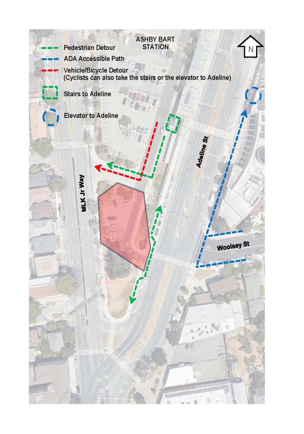
Work is scheduled to begin the week of April 29, 2024, on the installation of new segments of Class IV bicycle lanes at Ashby Station. Once completed, the new bicycle facility will provide a connection between Adeline Street and Martin Luther King Jr Way through the BART parking lot, formalizing bicycle circulation in and out of the Adeline Street driveway. Curb ramps on Adeline Street at the driveway will also be upgraded.
Construction impacts will include the following:
- The Adeline Street exit driveway will be temporarily closed.
- The 13 parking spaces at the south end of the parking lot will be blocked.
- Parking spaces for GetAround will be temporarily relocated.
- Pedestrians traveling north-south on the west side of Adeline will be routed around the work area with barriers, ADA-compliant ramps, and temporary wayfinding signage.
- When the project is completed, the south driveway on Martin Luther King Jr Way will be converted to inbound vehicle movements only.
Most work will be carried out between 7 am and 5 pm on weekdays. The work is expected to last 3-4 months.
In addition to BART’s project, City of Berkeley is currently designing additional bicycle improvements between the BART driveway and Woolsey to the east and between the BART driveway and Prince Street to the west.
Thank you for your patience as we complete this important work.
